Monday, August 23, 2021

Quick trip to LA on a Low Rider S

(Tuesday, August 17, 2021)  My 2021 Harley-Davidson Low Rider S had its 1000 mile service on Saturday, so on Tuesday I headed for Los Angeles to visit the Petersen Automotive Museum, and see Andrew and deliver his mail. I left the house at 11 and headed south on 101 through San Jose, Gilroy, and Salinas, stopping in King City for lunch and fuel for the bike. The Low Rider S replaced my Harley-Davidson Roadster, which suffered a rear end collision outside of Chico, CA in May. I was unhurt, but the bike’s frame was bent and the insurance company totaled the bike. The Roadster was based on the XL (Sportster) platform and had a 3.3 gallon tank (only 3 gallons of which was usable) and a sporty, almost cafe-racer riding position. The LRS weighs 100 pounds more, has a 5 gallon tank, mid-mount controls, and is based on the Softail (FX) platform. The engine is also 50% larger and delivers a huge amount of torque, most of which is available at very low rpms. 


Back on 101 I continued south towards San Luis Obispo, where the temperature dropped and the coastal fog came in. I stayed at a Roadway Inn in Santa Maria, and signed onto our Taco Tuesday Zoom meeting as soon as I arrived. Due to space limitations I didn’t bring my iPad, so I used my phone for the Zoom meeting and it worked fine. I also used my phone as a GPS on the bike. Using the Maps app on the phone, I could just make out the text at the top of the screen without reading glasses. After the meeting, I went out to search for dinner, but the dining options were limited. However, there was a Mexican food truck right in the parking lot so I ordered three fish tacos and a Mexican soda and ate in the room - the tacos were excellent. (265 miles)

(Wednesday, August 18). The next morning an unpleasant sight greeted me as I looked out the bathroom window to make sure the bike was still there - the bike was wet, and there was a slight drizzle. Due to the aforementioned space limitations I hadn’t brought rain gear with me, so I hoped that the drizzle would stop before I left, which it did. Breakfast in the lobby was limited, but adequate - coffee, pastries, yoghurt, and an orange. The sky remained overcast and misty, but the streets were beginning to dry by the time I left. The GPS directed me to CA 154 through the coast hills outside of Santa Barbara, and it was a good ride, the sparse traffic moving right along. I was able to enjoy about half of the twisty descent into Santa Barbara before I became stuck behind a very slow-moving car. 

Back on 101 I continued along the coast and stopped for gas in Ventura, then followed the GPS to I-405 and then to Fairfax Blvd. and Wilshire Blvd. in LA where the Petersen Museum is located. This is a fairly new building and is well thought out. The parking garage is part of the building, which has three floors of exhibits. I had prepaid, so I just showed a printout with the bar code and went up to the third floor, where I wandered through exhibits of cars (and one FN motorcycle) from the early 20th Century. The lighting in the museum is a bit dim, the signage is informative without being overwhelming and in a font that I could read without readers. The cars are spaced so that you can walk around them, and there aren’t so many that they all blur together. The next (2nd) floor has exotic cars, sports and racing cars. The early (1952) Ferrari Barchetta was parked near Steve McQueen’s 1956 Jaguar XKSS and a beautiful French Delahaye.


James Hetfield is the vocalist and rhythm guitarist for Metallica and is also a custom car guy. He’s worked with noted builder Rick Dore on many creations, several of which were on display.


There was a special exhibit of off road vehicles - everything from a replica of the Mars Rover to a 1916 Harley Davidson with sidecar like the one that Effie Hotchkiss rode across the country from Brooklyn to San Francisco with her mother, Avis, in the sidecar. (Mom didn’t think it would be respectable for Effie to ride alone.)


There was a section for race cars including a room full of Formula One race cars, a Triumph that competed in the Baja 1000, and a 1.1 liter Porsche that won its class at Le Mans in 1951.


This being Los Angeles, there were over a dozen cars and motorcycles that were used in movies and TV shows, including the Batmobile from the 1960s TV show. The bike was based on a 1966 Yamaha YDS3, which was my first bike.


There was also a nice example of a Nash-Healey, a 1950s sports/grand touring car that preceded the Thunderbird but was a similar concept.


Two hours well spent. I pulled out of the parking lot and turned onto Fairfax, which I followed to Hollywood, then left and right onto Laurel Canyon where I rode past The Store and up the winding, slow, and crowded road for a few miles and then down toward Ventura Blvd. where there was a large traffic jam. After waiting through at least three light cycles, I finally turned off Laurel Canyon and went around the troublesome intersection and then onto 101 and I followed the Map app to Burbank and the Portofino Inn where I’d booked a room. The room wasn’t quite ready, so I walked to a nearby Starbucks and had a late lunch and coffee. Back at the motel I cleaned up in the room and texted Andrew to let him know I was nearby and he said to come right over. 

At Andrew’s apartment I met his kittens, Pan and Momo, and then used his iPad to Zoom into our Wednesday (every 4 weeks or so) meeting with several friends from college, after which Andrew and I drove to Talleyrand, a restaurant near my motel that serves traditional American diner food. Back at Andrew’s apartment we talked awhile, then I rode back to the motel and turned in.

(Thursday, August 19). I was out of the motel before 8:30 and rode north on I-5 to Castaic Junction where I went west on CA 126 to Santa Paula and then north on CA 150 to Ojai, where I got gas at the nicest Chevron station I’ve ever seen - flowers on a side table in the Men’s Room! CA 150 was a nice and curvy road that went through hills, but there was a bit of traffic and some road construction. The nice thing about the Harley is that I enjoy just cruising along on it and don’t feel like I have to pass everyone so that I can go fast on the road. In Ojai I went north on CA 33 past Wheeler Springs and then up and over Pine Mountain Summit (about 5000 feet), a great ride with good pavement and lots of curves, marred only by a couple of construction zones with pilot cars. Descending, 33 went through Lockwood Valley past Blackwell's Junction , where James Dean crashed and died, to CA 166/33 where I went east to Maricopa where I stopped at Tina’s Diner for lunch. This little town has a gas station and convenience store, but Tina’s seems to be the only business downtown.


I followed 33 north and soon rode by the Wonderful Pistachio and Almond company, which is a huge operation with several buildings and a large parking lot full of about 200 cars. North of Taft there were miles of oil fields, and then into Coalinga, where I filled up and then rode west on CA 198. This is familiar territory but always enjoyable and I enjoyed the curves and scenery and lack of other vehicles. I went north on CA 25 to Hollister and 10 miles later went north on 101. I stopped in Gilroy for a final fill-up, and an hour or so later I was home in San Francisco. The Harley worked just fine on the freeway and the back roads, and handles better than anything that heavy has a right to. I’m looking forward to more and longer rides on it - I have panniers (saddlebags) on order. (450 miles)


Wednesday, June 30, 2021

Home to San Francisco from Denver

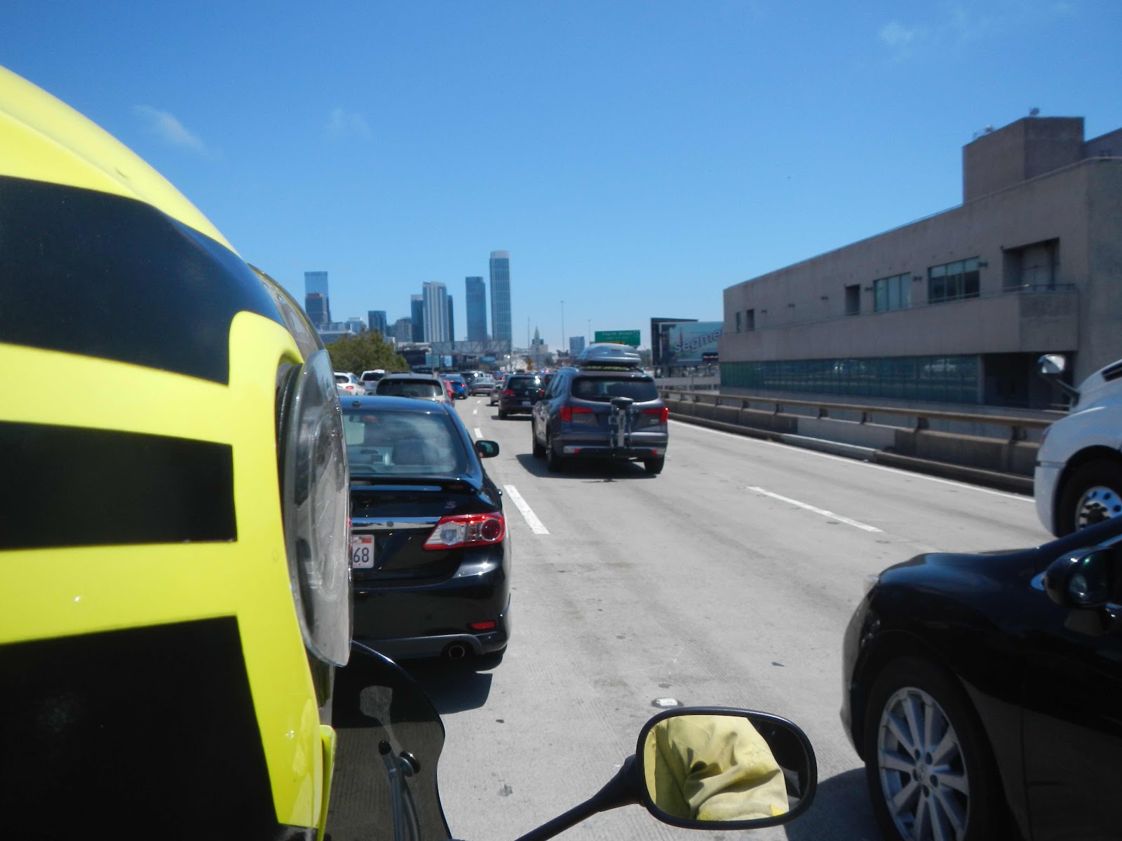
(Wednesday, June 30)  Dinner last night was at Death & Company on the first floor of The Ramble. Death & Co. started in New York City and the Denver outpost was established just a few years ago. (There is another in Los Angeles that is still under construction.) D & C is primarily a cocktail bar with a very extensive selection of complicated cocktails using premium ingredients. The food is upscale bar food - hamburgers, salads, appetizers, all quite good. We enjoyed our stay at The Ramble, and dinner. In the morning we had coffee and muffins from the D & C kitchen, Yesterday evening Carol had packed all her bike gear and clothes into a duffle bag that we’d shipped to The Ramble, and in the morning I shifted around a some of my stuff and also bike related items (air pump, battery pack) to the now empty pannier. I packed the bike, Vanya came by to pick up Carol and take her to lunch and then the airport, and I headed out of downtown to Centennial (south of Denver) where I made a quick stop at a BMW shop there to get a quart of oil and the plastic tool to remove the oil filler cap on the bike. (One came with the bike, but it is in a toolkit under the seat and I wanted one to keep handy.)

Back on the road I went west on CO 470 to US 285 south, which heads into the mountains. This road starts off at four lanes, then goes to two with occasional passing lanes. There was more traffic than I’d previously seen on a weekday on that road in the past, probably because like everywhere else people are out and making up for almost a year and a half of being shut down. I was dressed for the 75 degrees in Denver, but the temperature quickly dropped into the mid 60s, and lower, and the sky clouded over, typical at elevation in the mountains. Kenosha Pass is 10,000 feet, and Red Hill Pass just north of Fairplay is almost the same. Java Moose in Fairplay provided a good cup of coffee and a chef’s salad, and after getting gas nearby I was back on the road. 


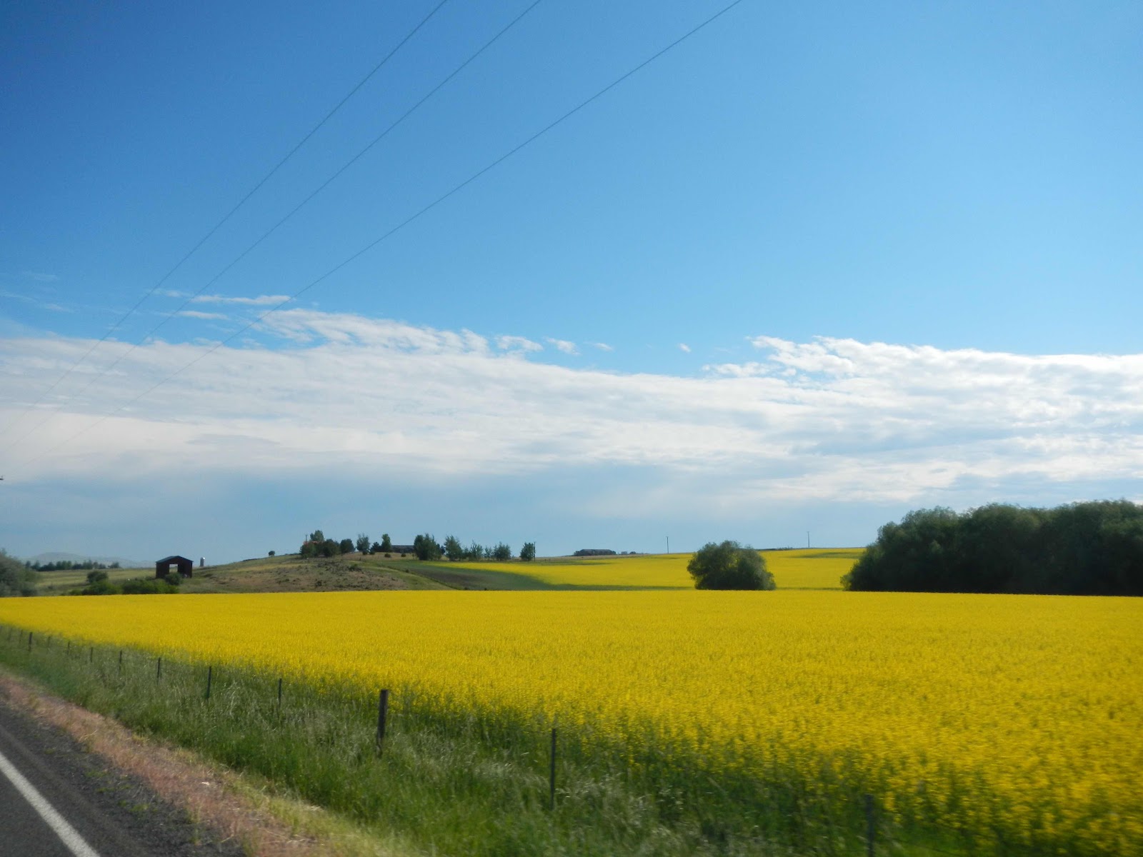
There had been a few light sprinkles and the temperature stayed low so I was wearing my cold gear. After Fairplay 285 descends a couple of thousand feet into a very large valley (I saw commercial signs that referred to the area as Big Valley) surrounded by mountains. The traffic moved along, and the cars and trucks that didn’t were easily passed. 

I’m spending the night at the Rio Grande Motel in Monte Vista (mountain view), Colorado, which is at the intersection of 285 and US 160. The motel is my kind of place - rustic and well-kept, but basic. The town is bigger than I thought it would be, with a downtown area of several blocks along US 160. 

Downtown artwork in Monte Vista
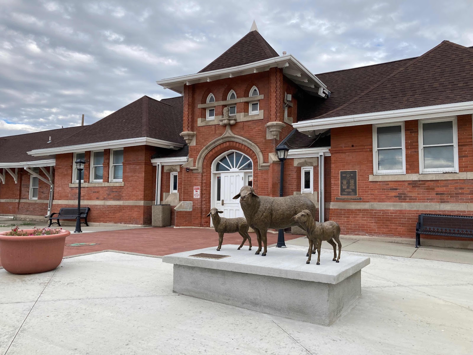
(There were about a dozen of these birds along the main street in downtown Monte Vista)

I had dinner at Los Lopez Taqueria (very good and muy authentico), and after trying to find non-alcoholic beer at a liquor store and a Safeway with no success, I returned to my hotel room to research possible routes for tomorrow. My plan had been to ride on 160 to South Fork, then take CO 149 north over Slumgullion Pass (11,361 feet) to US 50 a few miles west of Gunnison, then continue to Montrose and wiggle around western Colorado, eventually making my way to Moab, Utah. However, I had seen signs along 285 warning of road closures on US 50 between Gunnison and Montrose and advising people to check US50INFO.COM, which I did as soon as I got to the motel. Sure enough, the complete closures begin at 8 AM in the morning on weekdays with a couple of hours during the day when there is single lane traffic. I thought about riding up and over Slumgullion Pass to Lake City, and then turning around and riding back to US 160, but that would add 140 miles and about 3 hours to my day, so I reluctantly decided to follow Google Maps and just take 160 all the way to 491 into Utah and then Moab. So, tomorrow will be about 80 miles and a couple of hours shorter than I’d planned, less scenic, and over roads that I’ve been on before. Slumgullion Pass will have to wait for another time.

During this trip there have been inconveniences associated with construction and many more people than normal out on the roads and visiting attractions. However, after the year plus of not doing much of anything, I’m just happy to be out and about. (250 miles)

(Thursday, July 1)  The ride today turned out better than I had anticipated. At the recommendation of Dave, who runs the motel, I had breakfast about a half mile away at The Sunflour Bakery. There was one other person in the small restaurant, Jarrel, and he is retired and owns a Triumph Trident, a 2300cc, three cylinder monster cruiser that weighs well over 700 pounds. He said he used to ride Gold Wings, so maybe the Triumph seems normal to him. He’d been to Alaska (in a motor home) and we talked about the roads up there, and I asked him about the construction on US 50 between Gunnison and Montrose. He thought that the construction began west of the CO 92 turnoff, in which case I could ride that to Crawford and then go to 550 and south to Montrose - about 130 miles and three hours out of my way, and not what I’d decided on last night, but then Jarrel mentioned that if I did ride CO 149 over Slumgullion I should stop in Lake City for catfish. That got my attention, and I pressed him for details. He couldn’t remember the name of the place, but he described how to get there. Then I noticed that there was strawberry rhubarb pie in the display case, and I took this as an omen that I should chance 149. (The crust on the pie was delicious, light and flaky, but the filling was just OK.)  I walked back to the motel, packed, and finally left about 8:50 - since I’d thought I’d have a short day I had seen no reason to rush that morning. I discovered that the huge valley that begins at Fairplay and extends to Monte Vista and beyond is called the San Luis Valley.

I was dressed for the sunny weather, but it was still a bit cool. When I reached South Fork and the turnoff for C0 149 I took it and headed north. The road is in good shape and there was little traffic, but as we got higher it cooled down and became overcast with threatening clouds where I was headed. I stopped in Creede to reconsider and to put on my jacket liner and warmer gloves, and had just about decided to head back to South Fork when I asked the young guy in the visitors’ center about the catfish restaurant in Lake City over the pass. He said he’d never been there, but looked it up and said that the name was Southern Vittles. I also asked him about the road construction, and he said that all he knew was what was on the construction company website, which wasn’t very helpful - just a schedule of when the road had one-way traffic and when it was completely closed. The clouds had dispersed, so I decided to go at least as far as Lake City, and kept going north on 149. The road is mostly in good shape and there was little traffic, so I hustled along and didn’t stop at several scenic view turnoffs, thinking that I could stop on the way back to highway 160. There were ranches and vacation homes and a lot of empty, wooded land with the Rio Grande River never far from sight. The last few miles to the summit became steeper and twistier, but headed down the other side the road was quite steep with a few 15mph corners - in other words a lot of fun. Lake City turned out to be a charming place with ORV (off road vehicle) ranches, vacation homes, and an old downtown area of several blocks. I found Southern Vittles, but it didn’t open until 11, about 10 minutes away. I asked one of the waitresses, Maebee I believe her name is, about the road closure, and she said that the construction didn’t begin until west of the 92 turnoff, and in fact she had taken the detour just the other day. Reassured, I ordered catfish and fries and a sweet tea and decided that I would keep going. The catfish turned out to be breaded with a cajun spice, quite good but not what my friend CC would consider to be authentic. 


The town of Lake City is very laid back and comfortable - don’t tell anyone about it so it won’t get spoiled. I got gas at a local station, and headed north along a river, this time the Gunnison River, and after 30 miles or so came to US 50 and went west. It may have been my imagination, but it seemed that there was less traffic than I would have expected during vacation season - maybe all the warnings about road closures had scared people away. After 25 miles of enjoying the views of the high mesa and Blue Lake, I came to the turnoff for Crawford to avoid the road closure. However, there was a Park Ranger in front of me who took the detour, and I didn’t want to follow him for 50 miles at 45 miles per hour. Also, it was a little after 12:30, and I knew that there was a one hour window when the road would be open, albeit only one way at a time with a pilot car, so I decided to take a chance that the backup wouldn’t be too severe, and in fact after a couple of miles I came to the end of the line of about 50 cars. 


After about 10 minutes cars began to appear from the west, and after another 15 minutes the last one went by and shortly thereafter our line began to move. Slowly. After a mile or so we stopped again, waited and waited, and then cars began to come by from the west again. There are probably more cars headed west than east, so the road control does a double stop. This was unexpected, but after another 20 or 30 minute wait, we started moving again, and finally went by the area where the road is being widened and very large rocks from the cliffs above are piled along the shoulder of the road. By this time it was 1:30, and after our group went through the road would be completely closed for another 2-3 hours, so my timing was good and I lucked out. If I’d know at the beginning that the construction closure started west of highway 92, I would have never worried about the closure because if I missed the open window I could just take the detour. The website said nothing about a detour.

The backed up traffic was slow, but eventually it cleared and after 30 miles I was in Montrose, where I got gas, went south on US 550, and looked for coffee and a snack. The Dunkin’ Donuts was right across from a Wells Fargo, so I got a bunch of 20s (I started the trip with a lot of 50s, but have mostly been using 20s instead), had coffee and a donut, and was on my way. Montrose has a small downtown area of a few blocks, but most of the town is spread out along US 550 - every franchise you can think of. Eventually, I came to the end of the city and the scenery became more interesting. In Ridgeway most of the cars stayed on 550 to Ouray but I took CO 62 to Placerville and CO 140 west, but the remaining cars went on 145 east towards Telluride. Both 62 and 145 are very scenic roads and in good shape with good sight lines, curves, elevation changes, and little traffic. Just past Naturita I went west on CO 90 past Paradox (for once I didn’t ride into “town” to take a picture) and after a few miles of very tight corners and a steep climb crossed into Utah. The road goes through the La Sal mountains and is scenic, but you have to pay attention - a lot of fun. At the La Sal junction I went north on US 191 to Moab, where I’m spending the night at the River Canyon Lodge, a fairly new three story motel that is very functional, no frills, and well kept. The rooms are small, but have everything I need. The very talkative desk clerk recommended Thai Bella across the street, and told me where the local supermarket was located. She also told me that there was a severe housing shortage in Moab, but that they keep building more housing for travelers and vacationers, but nothing for the people who work in town to support the visitors.

I walked about five blocks through town to the supermarket at the south end, picked up Heineken Zero, and walked back to the motel. The town was lively with a lot of young people, and families with kids. There is an extensive mountain biking scene in Moab, jeep tours, ORV rentals and tours, and a few old people like me. The Thai dinner was very good and I ate about half of it and took the rest with me for breakfast. (370 miles, but they were tiring)

(Friday, July 2)  After leftover Thai for breakfast and a short walk to a NAPA store, I was on the bike, but not before I took a picture of the Jailhouse Cafe, where Andrew and I had breakfast after camping in a campground on the north end of town when he was nine or ten. 


At the entrance to Arches National Park a little after 8:30 the ranger said that they only let in as many people as the parking lots can handle, but that today they were open for business so far. I rode directly to Delicate Arch, which is on all the Arches brochures and everywhere that Arches Park is mentioned. There wasn’t much traffic, and it moved along at the low park limit. Delicate Arch is about 14 miles from the park entrance, and I parked the bike and joined everyone else who was hiking the half mile trail to the viewpoint, which is actually a quarter mile from the arch itself. The picture below was taken with the maximum optical zoom on my Cannon point-and-shoot. The people under and around the arch must have arrived there on a different trail.


One the way back I stopped at several viewing areas alongside the road, one of which was for balancing rock.


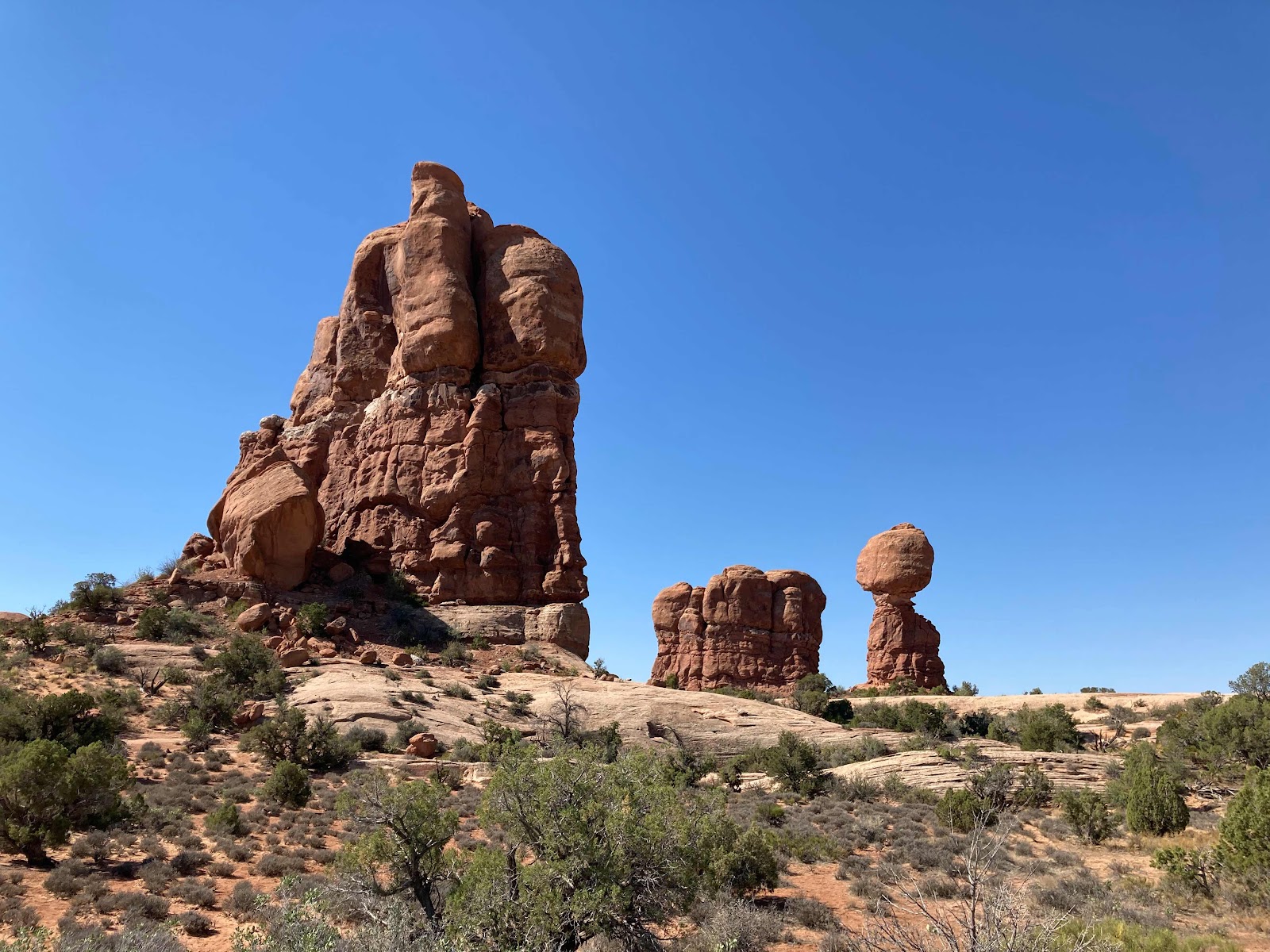
There were a few other interesting rock formations that could be seen from the main road, and many more I’m sure on the side roads. However, highway 95 through Glen Canyon has many red rock formations that can be seen from the road, and nearby Goblin State Park on highway 25 north of Hanksville has a large number of amazing formations.

More of the formations in Arches.


After an hour and a half I was at the visitors’ center and ready to leave. In the parking lot I met a guy from Wisconsin on a BMW GS who had been at the rally. By this time it was getting hot - about 90 degrees. Highway 191 north is flat and the scenery isn’t particularly interesting, and there was a certain amount of holiday traffic which moved right along. On I-70 I blasted along at 80 mph (the speed limit) for 20 miles and exited past Green River to continue on 191 north. The scenery became more desolate and a little after noon I stopped in Wellington at the Outlaw Cafe, which seemed to be the local seniors hangout, so I fit right in. Highway 191 becomes a freeway after Wellington and you have to exit if you want to eat or get gas in Price, so I was glad I’d stopped earlier. The road climbs over a couple of summits, and after an hour the sky clouded, the temperature dropped about 30 degrees, and there was a 15 minute rain shower. I didn’t bother stopping to put on my rain gear, and sure enough the sun came out, the elevation went down, the temperature climbed back into the 90s, and I dried out in about 20 minutes. 

My GPS decided to route me around downtown Provo instead of having me exit at Highway 189 which goes through the busiest part of town. Perhaps a good idea except that there was a small accident on I-15 north of the the 189 exit, which slowed traffic for a mile or so as everyone looked to see what had happened - not much from what I could see. Once through Provo I went north on 189 along the river until the GPS decided to have me get off about 10 miles south of Heber City so I could take a shortcut over Wassach Mountain. The road went through Midway and then climbed and twisted with some 15 mph uphill corners that had me in first gear. The GPS wanted me to take even more of a shortcut up a couple of gravel roads, but I declined and eventually came into the back part of the Deer Valley Resort and found my sister’s condo. I unloaded the bike, started a laundry, unhooked the battery tender, checked that her car started OK, added air to a couple of the tires, and went to the airport to pick up my sister and her husband, whose flight had been delayed for two hours in Denver. The arrived eventually, somewhat frustrated with the delay and the full flight, but that is what flying is like these days. I believe that this is called First World Problems. (265 miles)

(Monday, July 5) The last two days were spent with my sister and brother-in-law at their ski condo in Deer Valley above Park City. On Saturday Linda and I went shopping on Main Street in Park City and the place was jumping with live music and many people walking around eating ice cream and enjoying the beautiful day. Dinner was salmon at the condo, and doing a lot of catching up since we hadn’t seen each other in two years. On Sunday we took a drive through Heber Valley and Midway, a very quaint town with many antique stores and artist studios. We had lunch at The Split in Heber City, and that evening we drove back to Heber City and had dinner at The Back 40, which is famous for their delicious fried chicken. They even had good NA beer.

Today I was up with the sun to get an early start because I had a lot of ground to cover. Linda took a picture of me loaded up and ready to go.


It was about 65 degrees when we said our goodbyes, and I rode through Park City to US 40 towards Heber City, but took the cutoff through Midway, which saves a few miles. In Charleston I went south on US 189 to Provo and decided to ride through the town since I didn’t expect many people to be up and about early on a holiday morning. However, an event (maybe a parade?) was being set up and there was a detour around 8 blocks of closed University Ave. Back on 189 I saw an open Conoco and braked hard to turn in, felt something bump against my leg, and saw my left system case (pannier) sliding down the road ahead of me. I was only moving at about 15 mph and the case was scratched a bit but didn’t pop open or appear to be otherwise damaged. Examining the case I saw that a small plastic tab on the case that keeps it from moving upwards when locked to the bike had broken off, perhaps when it tumbled off a luggage cart at a motel a few days earlier, or perhaps because it is a thin little tab made of plastic. I put the case back on the bike and counted on its weight and the fact that the tail bag was resting on the case to keep the case in place. Tomorrow I’ll call a BMW shop and see if the tab can be replaced, or if I’ll have to buy a new case.

After getting gas I went south on I-15 for thirty miles, exited at Nephi, went southwest on UT 132 to Lyndyl, then west on US 6 to Delta where I got gas at my usual gas station, and went west on US 50. As I rode through town I noticed that The Rancher restaurant was open for business - I’ve eaten there several times over the years and even stayed in the motel once. I continued on 50 to the Nevada border and Big Basin National Park where the road becomes very scenic and climbs up and over Sacramento Pass (7162 feet), then Connors Pass (7749 feet), and then into Ely, where I got gas at my usual Chevron travel stop and casino. Ely seemed quiet but most businesses were open. I’d planned to eat at the Silver State Cafe in Ely, but wasn’t hungry and decided to continue on to Eureka. In the 70 or so miles to Eureka I went over three more passes, ranging from 6500 feet to 7500 feet. All this road is very familiar territory to me - I’ve been over it literally dozens of times over the years. In Eureka I stopped at The Owl Club Cafe, where the expected “Help Wanted” sign was in the window. There was one waitress who was doubling as hostess and cashier, so service was a bit slow. The first time I ate at the Owl Club was back in the 1970s when Carol and I were at the start of a cross country motorcycle trip. I think we had camped at the Tom Scott campground outside Austin, and stopped in Eureka for breakfast. The waitress was moving slowly and was a bit bleary-eyed, and she explained that there was a rodeo at the fairgrounds the previous night, and that she had partied a little too hard. One Fourth of July a few years ago I was trapped in the Owl Club after breakfast because US 50, which is Main Street, had closed for the Fourth of July parade, trapping my bike at the curb. I watched kids on horses, a few old cars, a fire truck, tractors and more parade by, and after a half hour or so the road was opened and I was on my way. 

Back on US 50 west I went over another summit, then descended down a very twisty section of 8 miles or so to Austin, where I got gas at what used to be a Chevron station. Just after the summit and before the road gets really interesting the driver of a pickup moved onto the wide shoulder so I could get by - a nice gesture. After Austin 50 becomes less interesting aside from a few low passes, but there was 40 miles of fresh chip seal that had to be ridden carefully - the chip seal leaves a lot of gravel in the roadway, and sometimes the oil that is used isn’t all absorbed. After the morning chill, the temperature had been mostly in the 80s, but at the lower elevations it went up and I saw over 100 degrees outside of Fallon, where I’m staying at a Comfort Inn on the west side of town which is one long strip mall at that point. Fallon has a small, old downtown and the excellent Courtyard Cafe, but otherwise has little to recommend it as far as I can tell. (547 miles, a piece of cake)

(Tuesday, July 7)  Last night I perused an online BMW parts fiche and determined that BMW does make the part that broke/went missing available so I planned to stop at a BMW shop in Sparks as soon as they opened in the morning to purchase one.  In the meantime I created a wedge out of two paper plates, jammed it between the top of the system case and the bottom of the luggage rack, and tied the wedge in place with zip ties.


It was 85 degrees when I pulled out of the motel parking lot and headed west out of town on US 50. The highway becomes four lane, divided in places, all the way to Fernley 30 miles west where there were at least 17 fast food places at the interchange with I-80. The scenery can be described as bleak on that section of I-80 towards Reno, but at least I was moving along unlike the people in the eastbound direction - there had been an accident that had closed the road, and it was now down to one lane and traffic was backed up for 10 miles. In Sparks the shop was just opening, and Tim the parts guy said that the part was available but not in stock. He said he could order it and have it shipped, and I said OK. I’d called A&S BMW in Roseville (just east of Sacramento on I-80) earlier and they didn’t have the part in stock either. 

Back on I-80 I rode through Reno into California and was waved through the agricultural inspection station. The road climbed up to Truckee and then over the Donner summit where it began the long descent into the Sacramento Valley. The road is in good shape, and there was surprisingly little traffic. The previous evening I’d emailed an old friend from work who was also a riding buddy. We’d been to Alaska two times, to northern Alberta, motorcycle shows, and other trips together. He and his wife, Carol (who also worked where we did), purchased a house in Auburn a year and a half ago. I’d asked if I could stop by, and John said sure, and that Carol would make us a quick lunch that would be no trouble. It tasted as good as it looks.


Far healthier than my usual fare along the road for the last three weeks. The house is on a cul-de-sac and they recently installed an 8 kw Tesla power wall. The batteries are far smaller than I’d imagined, and the whole unit seems well thought out and integrated. John and Carol recently adopted a husky/chihuahua mix dog that has the husky white eyes, and is larger than a chihuahua. She’s very friendly - a sweet dog. 

We said our goodbyes and I was back on the road. There was a long traffic jam on the eastbound direction of I-80 due to an accident on the center divide, but in my direction traffic moved along until west of Sacramento where the road goes from four to three then to two lanes that merge with I-80 business through Sacramento, and then everyone goes from five lanes to four to three. It takes time for drivers to sort all this out and I’ve been through there at 10 PM and there is always very slow traffic. One of the few remaining things I like about California is that lane-splitting is legal, and many drivers even pull over slightly to let you through. I stopped in Vacaville at a Harley shop where my Roadster is awaiting repair. I was rear-ended at the end of May on my way to Chico for an old motorcycle show and swap meet. Remarkably, I wasn’t hurt at all, but the bike, though rideable, suffered expensive damage and the shop was waiting for an appraiser from the insurance company to come by and see if the shop’s estimate is reasonable. (The insurer’s initial estimate was based on several pictures I took of the bike and emailed to the appraiser, who is located in Kansas, I believe. Based on the photographs, he did a good job of picking up on the various parts that would need to be replaced, but the labor cost was based on a shop rate of $75/hour, which is less than half of what shops charge in California.)

The temperature was a moderate 85 degrees when I left Fallon, dropped to 70 at the high elevation of Donner, and then was a moderate 85 in the valley. I checked WAZE in Vacaville, and was told that highway 37 was the best route home. There was a short tie up where the two lanes go to one for the 10 miles across the tidal basin, but otherwise traffic wasn’t bad. In Novato I went south on 101, across the Golden Gate Bridge, and into San Francisco where it was cool and foggy and windy. It was 59 degrees when I pulled into our driveway and immediately began unloading the bike. Carol came out to greet me, and then I went inside to see Walter. (347 miles)

It was a good trip with beautiful scenery, mostly good weather, friendly people along the road, and no problems or close calls. Everywhere we went in the mountain west people were friendly and helpful, and we had several conversations with fellow travelers in restaurants where we stopped along the way, often with someone who either has a bike or used to ride. I think that after over a year of semi-isolation the people who are out traveling are very happy to be out and about and more inclined to interact with strangers than they might otherwise be. Even the overworked staff in the short-handed cafes, restaurants, and motels were in good humor. When I was younger I went to a few of the large BMW rallies, but wasn’t all that interested because after a quick tour of the vendors I wanted to be back out on the road instead of standing around and talking with people. In those days there was a certain in-group of members who had been there from the formation of the club in 1972, and the other attendees were younger and there was a certain amount of macho posing about who had the fastest bike, who had covered the most miles getting there, and whose bike was the best. Now most of the people at the rally are not that much younger than I am, I’m one of those old guys, and I enjoy the interactions with other like-minded people. I’ll stop to look at a particularly well outfitted bike, and the owner will come up and start talking, we ask each other about the ride to the rally, and we find out that maybe we’ve been on the same roads and owned similar bikes in the past.

Carol just reminded me of one photograph I wish I’d taken: After our cowboy croissant at The Sandwich Shop in Saratoga, WY, she was sitting on a bench in front of the closed Sweet Marie’s cafe, pulling on her rain pants. It had been a cold and misty ride from our motel and it was still chilly, but the sun had come out and at that high elevation it warmed you right up, and Carol said that maybe we should just sit there for the next couple of hours. 

Now, where can I go next….  (three weeks and two days, 4,060 miles)


Sunday, June 20, 2021

Riding with Carol to Colorado via a BMW rally

Every year the BMW Motorcycle Owners Association (BMWMOA) holds a large gathering in a location chosen for its interest and access to interesting riding. In 2020 the rally was to take place in Great Falls, Montana, but of course COVID shut everything down. However, the club just pushed the rally to 2021 in the same location. Carol and I had signed up for the 2020 rally, so we decided to continue with that plan, just a year later.

We left on Sunday, June 20 at about 11:15 and immediately ran into a glitch when the connector to my Garmin GPS didn’t have power from the bike. I fiddled around with the wiring and got it working and we were finally off at about 11:30. There was another annoyance when we ran into heavy traffic on the Bay Bridge, which we later saw was caused by an accident on the east side of the Treasure Island tunnel. It was stop and go in first gear for a couple of miles and my bike’s oil temperature gauge was showing two bars above normal when I finally resorted to splitting lanes - legal in California, but something I don’t like to do on the Bay Bridge with its narrow lanes. The bike was loaded down and top heavy and Carol said that she just closed her eyes. Many car drivers were very accommodating and eased aside to let us through. Once past the cause of the mess, which had just been removed as we got there, the road was clear and we sped to an exit in El Cerrito where I stopped at a Home Depot to use their washroom and to pick up a few things to effect electrical repairs if needed later. Below is the approach to the Bay Bridge on the Central Freeway. 


And here is how the bike looks loaded down with our stuff. The panniers, tank bag, and tail bag are all official BMW gear and they work very well.


We followed I-80 to the I-505 cutoff in Vacaville with only minor slow traffic in Fairfield where the road goes from five lanes to four. I split lanes again for a few miles, but I-80 lanes are wide at that point so it is not a problem. The temperature was the usual fifty nine degrees in San Francisco, but once past Vallejo it climbed up into the 80s, and on I-505 into the nineties. By the time we reached I-5 it was up to 95 when we stopped at Granzella’s in Williams for lunch. This is a very good deli, gift shop and restaurant, but the service was slow and it took us an hour and a half. Wherever we stop we see Help Wanted signs in the windows. We continued on I-5 to Redding, where we stayed at the Thunderbird Lodge, which is nice enough but nothing special. The highest temperature I saw on the bike’s outside air thermometer, which is quite accurate, was 109. Northern California was taking the first day of Summer very seriously, even though the solstice wasn’t official until 8:20 PM. 

We met our friends, John and Karen, who were in the room next to ours and who had arrived in mid-afternoon. They had gone to Sacramento on Saturday (John on the bike, Karen in her car) where they dropped off the car and Karen’s two dogs with Karen’s sister and spent the night at her place. In Redding John and Karen spent two hours in a movie theater at a showing of Spirit, a kid’s movie. I asked John how the movie was, and he replied that it was indoors, air-conditioned, and that was all they cared about. We’d planned to hike to the Sundial Bridge, a local attraction that I’ve reported on previously (see the 2019 blog entry Riding with Nikki to Colorado), but it was too hot for the mile plus hike so we just had dinner at a good Japanese restaurant nearby and turned in. (220 miles)

(Monday, June 21) We left the hotel at 8:30 after a snack of coffee and donuts from nearby shop and immediately stopped at Turtle Bay so Carol, Karen and I could walk across the Sundial Bridge. John (who has been there before) stayed in the parking lot and attempted to repair one of Karen’s boots with tape. The sole of the boot had become unglued and was flopping around. Back on the road we went east on CA 44, which wasn’t our original planned route, which would have taken us east on CA 299 with a stop at Burney Falls. Nikki had texted us with a suggestion to visit the Subway Cave and Lava Tube where we could hike about a third of a mile underground in a lava tube where the temperature was a constant 46 degrees. Since it was already over 90 when we left in the morning, this sounded good, and I put in “Subway Cave Lava Tube” in my GPS and followed that to the turn north on US 89 and then to a wide area in the road, which we later figured out was a parking area for the trailhead to the Subway Cave. We had passed a Subway Cave exit several miles before that, and weren’t inclined to go back so we continued on to CA 299 where we went west for five miles to Burney, not having walked in a cool lava tube, not having seen Burney Falls, and adding 35 miles to our day’s ride. However, we had a good but very slow breakfast at The Blackberry Patch, and did I mention that wherever we went we saw “Help Wanted” signs? An hour and a half later we were back on the road and rode through northern California (the future site of The State of Jefferson, if you believe the signs that we saw), a very pleasant ride. In Alturas we went north on US 395, by Goose Lake, which was off to the west, and into Oregon and through Lakeview, which - isn’t much to see. The ride was hot, the scenery was bleak, and we were stopped for up to 20 minutes a time at road construction sites. Did I mention that it was hot - in the mid-high 90s? 


We finally reached Riley at US 20 where we turned east and stopped in Burns, Oregon at the Historic Central Hotel, where we spent the night. The motel dates back to the early part of the last century and a couple purchased it several years ago and restored and remodeled it and added many period artifacts, repurposed old building pieces, and fun posters and artwork. The hotel runs without onsite staff - they send a key code a few days before your stay that gets you into the hotel and your room, and this works quite well. It would have been nice to arrive at three in the afternoon and wander around the hotel, visit some of the shops in town, and relax in the pleasant outside patio, but as it was we arrived at 7:30 hot, hungry, and tired. The 1920s era music in the lobby cheered us up a bit, and we found a pizza place that was open about a half mile away, so Carol and I ordered a pizza, walked there to pick it up, and on the way back I stopped at a Safeway for drinks, picnic utensils, and a salad and sandwich. We ate on the patio and as the hunger eased we agreed that it all worked out quite well. Below is a picture of our room, the “Hop Gold”, which was the name of a brewing company back in the day. I wouldn’t mind going back there, but perhaps by a different route. (370 miles)


(Tuesday, June 22) There was a Keurig coffee machine in the hotel and I had coffee and the leftover half sandwich from last night’s dinner for a snack. John went to a nearby NAPA and found some Gorilla tape to repair Karen’s boot - the bright yellow, 500 degree (claimed) super tape had melted to a twisted mass. I also visited NAPA and purchased tape to patch Carol’s boot, which was wearing a hole in the upper behind the toes. We left the hotel at 8:45 and on our way out of town noticed that Burns isn’t such a bad place - nice city park at the north end, a coffee shop, and various antique and artist’s stores. Here are John and Karen loaded up and ready to go.


The day was warm - mid-70s when we left Burns - and cloudy so good riding weather. We followed US 20 over Stinkingwater Pass, then Drinkingwater Pass (both about 4500 feet and named after nearby rivers) for 60 miles to Juntura, where we had a slow breakfast at the Oasis café. Back on the road we stopped in Vale so Karen could take a picture of the Bates Motel sign, then through Ontario and into Idaho and then north on US 95. The day had warmed to the mid-90s and the traffic thinned but this is a somewhat busy road, being the only north-south road in the area. The scenery improved and in New Meadows became very pretty all the way through Riggins along the Salmon River and the Hell’s Canyon area. It was periodically cloudy, which gave the sky a certain drama, and the road was interesting enough to demand concentration.


We arrived at the Gateway Inn in Grangeville at 4:30, checked in, and had dinner at a Mexican restaurant across the street. There’s a gas station next door, an espresso drive-thru in the parking lot, and an emergency clinic next door to the restaurant, so all the essentials close at hand. John called two BMW shops nearby (well, within 100 miles) but neither had boots for Karen. The tape is holding up so far (after another repair at a rest area) so we may wait until we get to the rally, where there will be many vendors with footwear. At the same rest area where John played cobbler, a truck driver advised us that there was road construction with up to an hour’s delay on ID 13 between Grangeville and Kooskia, and suggested a detour to avoid it, and we will probably take his advice in the morning. (307 miles)

(Wednesday, June 23)  We are seeing more and more motorcycles, many of which are headed to the BMW rally in Great Falls. I spent time in the morning talking with a few of the owners, but we were still on the road at 8:30. We followed US 95 towards Lewiston, but after about two miles turned onto Old Highway 7 for 10 miles, and then went east on ID 162. The roads go through farm country and the yellow fields of rapeseed (canola) were beautiful as was the rolling landscape.


In Kamiah we went east on US 12, passed the turnoff for Kooskia, and headed towards Lolo Pass. This road is part of the Lewis and Clark Trail and it follows the Lochsa River. There isn’t much along the road except woods and the river with occasional turnouts for fishermen. There is one small town, Syringa, with a motel and café, and a lodge, which also has a café. The day was cool and somewhat overcast and we enjoyed the almost empty road. There are mostly gentle curves at the lower elevations and many places to pass. 


I was moving along at what I thought was a brisk but prudent pace, but at one point we were passed by a group of five or six riders who were in much more of a hurry than we were. As we began the climb to Lolo Pass (only 5500 feet or so) the curves became tighter, the road surface deteriorated a bit, and there were several passing lanes. A few miles before the visitors’ center at the top of the pass we passed by a dead deer on the side of the road, a motorcycle parked in the road, and what looked like an emergency response vehicle. Off to the left we could see a couple of other bikes and one guy standing up against a low wall with his arm in a sling. We surmised that he’d hit the deer, his bike was off somewhere else, his friends had stopped, and he was being attended to.  We stopped briefly at the visitors’ center, then continued on down the somewhat steeper descent to Lolo and Missoula. We’d planned to stop in Lolo for gas and food, but couldn’t see any restaurants that looked enticing, so we went through Missoula on US 93 north. All the traffic we’d left in the Bay Area seemed to have found us again, and every restaurant we saw was part of a fast food chain. The businesses that weren’t fast food restaurants were cannabis shop or casinos - Missoula does not present its best side on Highway 93. We finally had an early lunch at a Famous Dave’s Barbeque, which was OK and we were happy for the break by this time. 

Back on US 93 we went west on I-90 for one exit and then went north again on 93 through a few small towns and along the west side of Flathead Lake, a major recreation area. Carol and I have been by the lake a couple of times, but on the east side, which isn’t as developed. 


We came into Kalispell, found our luxury accommodations (an Econo Lodge), and checked in. When I checked in I overheard the desk clerk explaining to someone over the phone that there were no rooms available within 50 miles.  

In the morning we had learned that Glacier Park was limiting the number of vehicles on Going-To-The-Sun road, which we had planned to take. In addition to your park pass, you need to secure a temporary travel pass, available online or by phone. John and I had both attempted to get passes via phone and website, but they were all sold out. In Kalispell John tried again with the same result. Over dinner at the nearby Montana Club, we discussed our options. The very helpful person at the front desk at the motel had suggested going around the south end of the park, then up past Saint Mary to Babbs and heading east for 13 miles to the Many Glacier hotel where we could get a meal, sit on the patio, and enjoy just as good a view as we could at Logan Pass at the top of going to the sun. I’d checked out the map and did some arithmetic and determined that this would add 82 miles and about 2-3 hours to our ride. All of us except Karen had been through Glacier Park, and she wasn’t that interested in more miles and hours on the road, so in the end we decided to just go straight to Great Falls from Kalispell. (303 miles)

(Thursday, June 24)  We were out of the motel at 8 and headed north on 93 to downtown Kalispell, where we went east on US 2 to West Glacier and then along a river and RR tracks through a canyon to East Glacier. The road was narrow and rough in spots, but the speed limit was still 70 MPH, not that many people were keeping up with that, although some tried to. There was some traffic and not many places to pass. We followed this orange truck for quite a while before we were able to get around it.


The locals were trying to go 70 because they were familiar with the road and the visitors were trundling along at 55 and slowing down for the gentle curves. We rode by East Glacier and stopped for gas in Browning, which is on the Blackfeet Indian reservation. The gas station was also a grocery store, fast food place, and the local hangout. The temperature had started off at 58 degrees and stayed there most of the morning, gradually rising to 65. It sprinkled a bit, but not enough to get us wet - just enough to get the bike dirty from road spray. In Browning we went south on US 89 and 70 miles later pulled off in Choteau, a pleasant little town with a museum and rest area across from a deli/restaurant where we had lunch. Back on the road we discovered that the rest of the town had two or three other restaurants and what looked like a charming downtown area. 

US 89 was mostly deserted and went through very small towns every 50 miles or so. The landscape consisted of rolling ranch land with small clusters of cows, very pleasant to someone who is used to dealing with constant traffic and people everywhere.


Eventually we got on I-15 south to Great Falls and followed the GPS to the Expo Center and the rally. We checked in, checked out the vendors, Karen bought new boots, and Carol and Karen went to the Newbie building for a complimentary drink for those attending their first MOA national rally. It rained a bit, but we were indoors for the most part. The MOA wasn’t sure the rally would even be held until a few months ago, so the attendance seemed to me to be quite good - one of the organizers said they were expecting 5000 people. There weren’t quite as many vendors as usual, probably due to the short notice and understandable vendor skepticism that there would be enough people to support the work and expense of setting up a booth. 

You see all sorts of rigs at the rally. (240 miles) Friday will be spent all day at the rally and listening to rock ‘n’ roll in the evening!


(Friday, June 25)  Following a light breakfast at the hotel, we rode 3 miles to the Expo Park (fairgrounds) where the rally is being held. Most of the vendors are indoors in a large building with a dozen or so outside under canopies. There is some food inside the Pavilion (the large building) and half a dozen food vendors outdoors with areas to sit down. The seminars are held in three or four other, smaller buildings. Beyond those is the large tent area, with tents packed closely together. The rally attendance was expected to be about 5000 people, and probably 3500-4000 motorcycles. 


(the guy in the center of the picture above looks half there because it was a panoramic shot and he was moving. There is another parking area to the left with as many bikes.)


There were about 50 vendors in the Pavilion along with the very large MOA store which sold mostly clothing but other items as well. The vendors ranged from jewelry to custom fitted ear plugs (three of those), tire companies, helmets, motorcycle clothing, luggage, and very specialized motorcycle 
“farkles” - things that you add onto your bike that may or may not actually be useful. One of the People’s Choice awards is for the most farkled bike. We walked around the vendors, a couple of times and attended a seminar on organized tours (basically an infomercial for a tour company - but worthwhile) and one about touring Greece and Italy. The latter seminar was basically a home slide show by one of the key MOA members who keeps two older BMWs in Heidelberg, Germany. He also makes an annual tour to Mexico in late Winter (he lives in Colorado Springs, CO). 

John and I spotted this customized mid-80s BMW. The color scheme isn’t something I’d choose, but I had to admire the workmanship that went into the build - the owner said that he’d started out with someone’s abandoned project and that he’d painted everything himself in a homemade paint booth.


Note the aggressive rear tire on this on/off road bike.


Some people carry a lot of stuff.


(The bike above has a sidecar attached, which isn’t obvious due to the huge box on the back.)

Carol and Karen were not interested in the evening entertainment, so John and I dropped them off at the hotel where they dined on leftover pizza from the previous night. John and I returned to the rally site and ate there - I think that we had the better end of that deal. First up was Joanne Shaw Taylor, a blues rocker who is originally from England, but has been living in Detroit for some time. She is a great guitarist and vocalist, and the crowd enjoyed the show. Samantha Fish (check out some of her Youtube videos) was next and she came on and lit the place up. She did an encore of Shake ‘Em On Down with Ms. Taylor that was fantastic)
(Shaw and Fish in the pictures below)


The guy in the picture below shows up at BMW rallies and he was enjoying the show. He carries a trumpet that he blows every now and then.


Most of the people at the rally were at least in their 60s with many my age and older, but everyone enjoyed the show, which ran late and with the encore I didn’t get back to the hotel until 11:30.

(Saturday, June 26)  We were all out of the hotel by 8:30 and arrived at the rally just after 9 due to an unexpected tour of Great Falls caused by my argument with my GPS. We said our goodbyes to Karen and John who planned to attend a couple of seminars and were spending another night at the hotel before heading back to Tiburon. Just before the vendors shut down on Friday I’d order a set of custom ear plugs, and since they needed to cure for at least two hours (the vendor building shut down at 6) I was there to pick them up. Carol searched the MOA shop for a light jacket that suited her, but couldn’t find one, and eventually my ear plugs were ready and we got back on the bike, but not before I spotted this Honda Africa Twin that was parked nearby. The bike had a Mexican license plate and the owner (or someone) had crafted handsome plywood panniers for the bike. 


We were on the road out of town at 10:30, headed south and east for Billings. We followed US 89 (which at that point is also US 87, MT 200 and MT 3) for 20 miles and then went south on US 89 through Clark National Forest. The road mostly follows the Belt River, and after and hour and a half we stopped at a bar/restaurant in Neilhart for lunch. We spent some time talking with a couple at the next table who were a couple of years older than us. They used to travel all over on a Honda Gold Wing pulling a small camper trailer. They lived in Great Falls but were returning after a long road trip and hadn’t known about the rally, and when I told him about it he said that explained all the BMWs he’d seen on the road. Back on the bike we continued south on 89, over Kings Hill Pass (7400 feet - there is a ski area there) and gradually descended to White Sulphur Springs where we went east on US 12. 

It was a great ride on 89 through the forest and along the river, but now we were back in plains and ranch land.   


(You may have noticed that many of the pictures on this trip feature cloud formations. Carol has become the official photographer of the trip, and she takes pictures of clouds because she likes to paint them.)

It had been cold at the higher elevation on US 89, and on US 12 it was warmer but with a strong crosswind from the north. We followed 12 to Lavina where we went south on MT 3 to Billings and the Clock Tower Inn, where we are spending the night. Dinner was at Jake’s Steak House, which was good, and we split a crème brûlée for dessert. (220 miles)

(Sunday, June 27)  Breakfast is included at the Clocktower Inn, but we had been warned that Stella’s, the bakery/restaurant next door that supplies the breakfast, would be crowded, but there is a takeout option, which we chose. It was fine, and the coffee was good and we were on our way by 8:45. We rode west on I-94 for 15 miles and then went south on US 310 to Bridget, where we where we took MT 72 to the Wyoming border where it became WY 120, which we followed into Cody where I got gas. It had warmed up into the mid-70s and Cody was crowded with vacationers, most of whom were probably headed to Yellowstone. Good luck with that - we’d heard there were long lines of cars in the park and access to get in was limited. We continued on 120, which shows on the map as a scenic route, but Carol has a dispute with their definition of scenic. We stopped in Thermopolis (hot springs nearby) for coffee and a muffins (quite good) at Elle’s bar and restaurant, which was very quiet compared to the crunchy places on the other side of the street. I’ve been through Thermopolis half a dozen times over the years and this time was the busiest and coolest. Back on the bike we rode through Wind River Canyon, which actually is scenic, past the Boysen Reservoir, where Andrew and I camped out on our motorcycle trip to Missoula when he was nine.


In Riverton we stopped for gas because there didn’t appear to be any towns that would have a real gas station on our route to Rawlins, and as it turned out I was right. In the morning we’d quickly climbed up to 5000-6000 feet, and later to 6000-7000 feet and it stayed that way until Rawlins. Billings was about 75 degrees when we left in the morning, Cody was 70 degrees, and Rawlins 65 when we arrived. It was very windy at the higher elevations with the temperature dropping to below 60 at times, and that and the wind made for a tiring day.

In Rawlins we quickly found the La Bella Motel, which Carol quickly pointed out was my kind of place, not hers. 


The nearby Conoco where I purchased gas had an interesting mid-50s Cadillac in front.


Since we’d had an early breakfast and just coffee and pastry for lunch, we were both quite hungry, but the two restaurants close to the motel were both closed. One had a sign in the window that said they were closing at 4 PM due to shortage of staff. We asked at the Conoco station about a restaurant, and were told that Buck’s right downtown (about two miles away) was open, so we got back on the bike and went there. They were open and busy, and while we were waiting for a table to become available we walked around the downtown area, which was quite nice in a typical old western town sort of way.
Carol is standing in front of an old church. The train depot has a small park next to it and there seems to be a constant flow of freight trains.


Tomorrow promises to be more of the same unseasonably cold weather with a good chance of rain as we get further into Colorado. (370 miles today)

(Monday, June 28)  In the morning I added a little oil to the bike and a little air to the front tire. We left La Bella at 8:10 and it was 56 degrees and misting (it had rained overnight). We went east on I-80 for a few miles (where it was 52 degrees) then south on WY 230 to Saratoga, WY and our anticipated breakfast at Sweet Marie’s restaurant and bakery where we saw this sign posted in the window.


We walked around town looking for someplace else, but Duke’s was closed (it’s a bar/cafe and probably doesn’t open until later) as was the Hotel Wolf dining room - in fact it was closed for two weeks. We walked into the hotel and went upstairs so Carol could see room 9, which is the Joe Pickett room (named after the main character in C. J. Box’s popular thriller series who stayed at the Hotel Wolf once). We finally both had Cowboy Croissants (an egg sandwich, but in a croissant) at the sandwich shop, which were fine and very filling. I have to wonder how many old cowboys actually ate croissants. 
The sun had come out but it looked threatening to the south where we were headed, so we put on all our rain gear, and indeed we did hit a few light showers in the next 100 miles. It was also quite cold - 45 to 50 degrees - with skies that became dramatically threatening. 


We had been at 6-7000 feet, but we climbed up to 7-8000 feet as we rode south and into Colorado where WY 230 became CO 125. We rode through Walden (Andrew and I camped there many years ago on a motorcycle trip) and went over a 9600 foot pass in the Routt National Forest. The pine beetle infestation and last year’s fire have taken a heavy toll on what I remember as a beautiful forest.


In Granby, CO we went east on I-40 through town where I got gas, and then continued through Winter Park, which impressed Carol with its level of development with new condominium buildings everywhere and more under construction. Then over Berthoud Pass (11,300 feet) and east on I-70 to Idaho Springs where we stopped for coffee and pastries at a Starbucks. By now it had warmed up into the 60s, so we were quite comfortable after the cold weather in the morning. The backroads of the morning were very lightly traveled, and US 40 had more traffic, but still everything moved along. We followed the GPS on I-70 into Denver, where we went from three lanes to one due to road construction (as usual, no actual constructing taking place) and it was stop and go for several miles until the construction cleared just before we went south on I-25 and exited on Park Ave. and downtown Denver. We went by Coors Field, where a Rockies game had just begun, and then found our way to the Ramble Hotel on 25th St. where we are spending the night. It is an upscale place with laid back vibe and quite nice. We checked in, walked to Vanya’s place, where she and Rocky greeted us enthusiastically. Vanya had just returned from a month in Baja near Todos Santos, and we hadn’t seen her for a year and a half and what with our trip, her trip, and the long time between actual visits, we had a lot to talk about. We walked back towards our hotel on Larimer St., which is sort of an outdoors arts area with many murals on the buildings. We ate at an Italian restaurant, went back to Vanya’s, and then Carol and I walked back to the hotel. 

Carol’s part in this motorcycle adventure ends in Denver. She will stay until Wednesday and then fly home to San Francisco to get ready for a trip to Maine to stay at Alden Camps and see family. Nikki and Vanya are also flying to Maine - I will be at home attending to Walter the dog and Joey, Nikki’s cat. This is the first motorcycle trip Carol has been on since 2015, so jumping right into an eight day, 2300 mile ride with grueling heat as well as cold temperatures was real test, which she passed with no complaints, and she is still talking to me. 

Carol had been to a couple of small, local BMW club rallies before (attendance about 500), and also a couple of vintage motorcycle shows, but never to a national rally with its 5000 attendees. I asked her what she thought of the rally, and she said that she always felt that she was surrounded by large men. (255 miles today)