After a week of riding I've found the rhythm of the road. That is when you've finally discovered where all your gear is packed, a gas station appears just when you want one, a likely cafe is alongside the road when you are hungry, there's no traffic, the weather is perfect, the scenery is interesting, and the wind always seems to be at your back (which is often the case when riding from west to east).
After yesterday's extra 115 miles due to full motels, I slept in and got a late start. The first stop was the Little Big Horn National Monument, site of Custer's Last Stand. This is a surprisingly popular site and there were tour buses in the parking lot, and many people watching the video presentation in the theater, on tours with rangers, and examining the artifacts in the visitor's center. I'm actually not that interested the Battle of Little Big Horn, but apparently many people are, perhaps because there have been several TV specials about it. In any case the visitor's center is well-designed, the exhibits are interesting, and the paths around the battlefield area are well documented.
US 212 runs gently southeast through rolling hills, hay fields, and rocky buttes. There wasn't a single curve that required rolling off the throttle, but it was a relaxing and pleasant ride, helped by the very reasonable 70mph Montana speed limit and few cars. Montana seems to have a surfeit of casinos. There were only a few towns along the road, but each one had at least two casinos - even if there was no gas station. The morning was quite hazy from the forest fires in Washington and Canada, but the haze dissipated the further east I went. US 212 goes through a little corner of Wyoming and then into South Dakota. At Belle Fourche I turned south on US 85 through Spearfish and rode through Spearfish Canyon, a very pretty drive along the Spearfish River through the Black Hills National Forest. The speed limit was only 35mph, so I kept the speed down a bit and enjoyed the scenery. I rode through Lead and then Deadwood, and there were more cars and motorcycles on the road. Deadwood looks the same as it did 10 years ago when I drove through there with Andrew, and I didn't stop. US 385 goes south through the forest and there was a fair amount of traffic - it was Saturday and this is a popular tourist area - but it moved mostly at the limit and there were places to pass. I turned east on SD 44 and stopped just outside Rapid City to check the GPS for a motel. It seems that there's a big music festival in town and many motels were full, but I found a slightly seedy place that is fine. It is called the Time Inn Motel, and next door is the Time Out Lounge and Casino.
Tomorrow I'll visit Badlands National Park, and ride across South Dakota.
Saturday, July 19, 2014
Friday, July 18, 2014
An old classmate, Yellowstone, Beartooth
At the 50th reunion of the Euclid High School class of 1963 I met Bob, whom I hadn't seen since High School. We discovered that we both enjoy long distance motorcycle riding, and he invited me to stop by his house in Big Sky, Montana, if I was ever in the area. So, this morning I rode towards West Yellowstone and stopped at Bob and Sylvie's house, which overlooks a ski resort. We talked for a couple of hours about our motorcycle trips and he showed me the bike that he and Sylvie rode in two Iron Butt rallies. (For those of you who don't know: The Iron Butt Rally runs every two years and entrants have to visit several checkpoints and also collect bonus points by visiting various sites around the country. Typically, riders cover over eleven thousand miles during the eleven days of the event. Very few entrants ride two up, and Bob and Sylvie did it twice.
Yellowstone Park was what you might expect in mid-summer - crowded. The traffic situation wasn't helped by the fact that for some reason people think that it is just fine to stop in the middle of the road to take a picture of a bear or moose or bison. In one such jam I overheard a woman, who was walking on the road, tell the driver of the car ahead of me that all the people alongside the road with cameras on tripods and large binoculars were there because someone saw a bear on the hill. There was a black dot about 300 yards away that could have been a bear, I suppose. People - go up to Squaw Valley or Heavenly in the winter and you'll have bears on your back porch. Yellowstone Canyon was impressive as always, but I was just passing through on my way to the northeast entrance and Cooke City. The Beartooth Highway begins there and goes over Beartooth Pass (almost 11,000 feet) and then down into Red Lodge, and it is over 50 miles of curves, switchbacks, and stunning views, which you mostly don't see if you are concentrating on the road like you should. The weather over the Beartooth can be rough, but today it was gray and cool but dry.
I'd planned to spend the night in Red Lodge, but I discovered that there was a Harley rally in town and there were no vacancies. I stopped for gas and while I was there it began raining, so I put on my rain gear and swapped out the sun shield on my helmet for a clear one. By the time I left the station the rain had stopped, and five miles outside of town it looked like it hadn't rained for a month.
There were no rooms in Billings, either (a large wrestling tournament, I was told) so I rode another 45 miles to Hardin, where I'm spending the night. Tomorrow I'll probably visit Little Big Horn, site of Custer's Last Stand, and try to figure out what I'm going to do with all the time I have between now and the BMW rally in St. Paul next Thursday.
| The BMW K1200GT which Bob and Sylvie rode in the Iron Butt |
| Bob and Sylvie are riding this CVO Harley to Vermont in a couple of weeks |
Yellowstone Park was what you might expect in mid-summer - crowded. The traffic situation wasn't helped by the fact that for some reason people think that it is just fine to stop in the middle of the road to take a picture of a bear or moose or bison. In one such jam I overheard a woman, who was walking on the road, tell the driver of the car ahead of me that all the people alongside the road with cameras on tripods and large binoculars were there because someone saw a bear on the hill. There was a black dot about 300 yards away that could have been a bear, I suppose. People - go up to Squaw Valley or Heavenly in the winter and you'll have bears on your back porch. Yellowstone Canyon was impressive as always, but I was just passing through on my way to the northeast entrance and Cooke City. The Beartooth Highway begins there and goes over Beartooth Pass (almost 11,000 feet) and then down into Red Lodge, and it is over 50 miles of curves, switchbacks, and stunning views, which you mostly don't see if you are concentrating on the road like you should. The weather over the Beartooth can be rough, but today it was gray and cool but dry.
I'd planned to spend the night in Red Lodge, but I discovered that there was a Harley rally in town and there were no vacancies. I stopped for gas and while I was there it began raining, so I put on my rain gear and swapped out the sun shield on my helmet for a clear one. By the time I left the station the rain had stopped, and five miles outside of town it looked like it hadn't rained for a month.
There were no rooms in Billings, either (a large wrestling tournament, I was told) so I rode another 45 miles to Hardin, where I'm spending the night. Tomorrow I'll probably visit Little Big Horn, site of Custer's Last Stand, and try to figure out what I'm going to do with all the time I have between now and the BMW rally in St. Paul next Thursday.
Thursday, July 17, 2014
A new tire, a bad bearing, and Philipsburg
This morning I parked by the service entrance of Big Sky Motorsports, the Missoula BMW dealer, fifteen minutes before the shop opened. There was a new R1200GS water-cooled bike already there, and the owner and I talked about our trips until the shop opened. They put my bike up on the rack right away, and about half an hour later the service manager told me that the mechanic had noticed that I had oil seeping from the pivot bearing area on the rear drive. This is something that could last another 5000 miles or it could fail in the next 10 miles. I asked if they had the parts in stock, and if they could do the work. He said that they probably didn't, and that they were heavily booked for the day, but he would check. It turned out that they did have the parts, and he was able to squeeze me in between other appointments. It saved a little time since the bike was already partly disassembled for the tire change. They even had time to balance the throttle bodies. I was back on the road at 1 PM and noticed a big difference when shifting and rolling off the throttle - no more jerk and clunk from the rear end. I also noticed that the bike was slightly smoother (throttle bodies). I really should have noticed myself that the play in the rear was getting worse, but the shop where I had a major service done a month ago should also have noticed the problem. So, props to Big Sky!
The unplanned half-day in Missoula meant that I wouldn't be able to visit Bob in Big Sky in the afternoon like I'd wanted to, but he said that Friday morning would be fine. Missoula is a town that grew too fast, and the main thoroughfares are congested. I got out of town and onto I-90 and cruised along at the 75 mph speed limit, enjoying the big sky scenery.
After about 50 miles I exited south on MT 1 towards Philipsburg, an old mining town. If you ever read James Crumley's novel, The Last Good Kiss (and if you haven't you should), then you will know that the book is dedicated to the poet Richard Hugo, from whose poem "Degrees of Gray in Philipsburg" the title of the novel is taken.
Philipsburg is no longer a run-down mining town, but has become a touristy and quaintly restored old town. Gem stores, jewelry stores, a huge candy shop, and various bars and restaurants compete for the traveler's dollar, but the town stops short of being tacky. I'd hoped to find out what, if any, connection Richard Hugo had to the town, but the museum closed early, and I didn't want to interview every shop owner who looked old enough to have been around 40 years ago.
Back on MT 1 I headed south to Anaconda, which, although the huge mine closed in 1980, still looks like an old mining town, at least judging by the enormous mound of tailings outside the town and the large number of bars in the town.
Back on I-90 I rode east over the Continental Divide and Homestake Pass (6300 feet) where there was a brief sprinkle of rain and the road was wet from a previous shower. It had been 95 degrees when I left Missoula, so the little bit of cloud and rain brought pleasantly cooler weather, at least until the road descended to a lower elevation. I'm spending the night in Three Forks, MT, where I'd hoped to stay at the Sacajawea Hotel, but it looked rather expensive (and full), so I'm at the Broken Spur Motel instead. Just as well, because it turns out that Sacajawea did not actually stay at the Sacajawea Hotel, and indeed had no connection to the establishment.
Tomorrow I'll visit Bob and Sylvie in Big Sky, and go into Yellowstone. If the weather is good I may ride the Beartooth Highway.
| This bullet-nose Studebaker was parked a couple of doors down from Big Sky |
After about 50 miles I exited south on MT 1 towards Philipsburg, an old mining town. If you ever read James Crumley's novel, The Last Good Kiss (and if you haven't you should), then you will know that the book is dedicated to the poet Richard Hugo, from whose poem "Degrees of Gray in Philipsburg" the title of the novel is taken.
You might come here Sunday on a whim.
Say your life broke down. The last good kiss
you had was years ago. You walk these streets
laid out by the insane, past hotels
that didn’t last, bars that did, the tortured try
of local drivers to accelerate their lives.
| Downtown Philipsburg |
| One of the old buildings - now a brewery |
Back on MT 1 I headed south to Anaconda, which, although the huge mine closed in 1980, still looks like an old mining town, at least judging by the enormous mound of tailings outside the town and the large number of bars in the town.
| The face of the building shows why the Club Moderne was so named |
Back on I-90 I rode east over the Continental Divide and Homestake Pass (6300 feet) where there was a brief sprinkle of rain and the road was wet from a previous shower. It had been 95 degrees when I left Missoula, so the little bit of cloud and rain brought pleasantly cooler weather, at least until the road descended to a lower elevation. I'm spending the night in Three Forks, MT, where I'd hoped to stay at the Sacajawea Hotel, but it looked rather expensive (and full), so I'm at the Broken Spur Motel instead. Just as well, because it turns out that Sacajawea did not actually stay at the Sacajawea Hotel, and indeed had no connection to the establishment.
Tomorrow I'll visit Bob and Sylvie in Big Sky, and go into Yellowstone. If the weather is good I may ride the Beartooth Highway.
Wednesday, July 16, 2014
The wrong damn dam
This morning (Wednesday, July 16) I was on the road early because I had a long day ahead on twisty back roads. I wanted to spend the night in Missoula or close to it, and yesterday's detour had left me over 400 miles away. Baker City, OR is a proper city with a real downtown area, and I was soon through town and on I-84, which I took north for one exit to OR 86, which goes east to Oxbow and the Snake River and Hells Canyon. It was a very pleasant and mild morning and I enjoyed the road and the scenery. After 60 miles I came to Oxbow, where I would follow the river to the dam and cross into Idaho. Unfortunately, I had it in my mind that I was going to the Hells Canyon Dam, and I followed the signs for that. The road along the river was old and patched but a lot of fun with no traffic and tight corners. After 23 miles I came to the dam, and was disconcerted to find that the road ended at the Visitors' Center. I asked the Ranger what I'd done wrong (although I'd begun to suspect my error) and she informed me that I should have followed the signs in Oxbow for the road to the Brownlee Dam, which takes you into Idaho, ID 71, and the town of Cambridge. She was nice enough to tell me that I wasn't the first person to make that mistake. So, as much as I'd enjoyed the ride to the dam, I wasn't that happy to repeat it. In Oxbow I saw the clearly marked sign to the Brownlee Dam and Cambridge, and I followed the road along the river in the right direction. This road was every bit as much fun as the other road, and in better shape. The guys I usually ride with monitor their on-board GPS units every quarter mile, and I've become used to having them correct me if I take a wrong turn. I'll have to pay better attention to my old-school paper maps...
ID 71 ends in Cambridge at US 95, which goes north through small towns, hills, valleys, and woods. There were road construction delays in several spots, and the temperature was in the mid-90's, which was uncomfortable when I was waiting for the flag person to let us through. Otherwise it was a pleasant ride through Riggins to Grangeville, where I took ID 13 to Kooskia. A few years ago four of us went on this little canyon road on our way to Glacier Park. I'm happy to report that it is still bumpy and twisty and hasn't been improved. In Kooskia I went east on US 12, which follows the Lochsa River and the Lewis and Clark Trail.
Since I hadn't eaten anything since breakfast and it was almost four in the afternoon, I stopped at an excellent cafe along the road and had a small meal of salmon chowder and a salad. Refreshed, I continued east, enjoying the gently twisting road and the ever-present river. The speed limit is an unrealistic 55 mph - even 50 near the pass - but there weren't any Idaho Troopers about, or much of any other kind of traffic. In any case there were plenty of passing zones and once over the Lolo Pass and into Montana the speed limit was a more sensible 70 mph.
I'm spending the night at a Super 8 in Missoula, since it was the first place I saw, and I didn't want to spend time searching for my usual picturesque motel. At least it is conveniently close to the BMW shop.
| Nice road. Too bad it goes to the wrong dam. |
ID 71 ends in Cambridge at US 95, which goes north through small towns, hills, valleys, and woods. There were road construction delays in several spots, and the temperature was in the mid-90's, which was uncomfortable when I was waiting for the flag person to let us through. Otherwise it was a pleasant ride through Riggins to Grangeville, where I took ID 13 to Kooskia. A few years ago four of us went on this little canyon road on our way to Glacier Park. I'm happy to report that it is still bumpy and twisty and hasn't been improved. In Kooskia I went east on US 12, which follows the Lochsa River and the Lewis and Clark Trail.
Since I hadn't eaten anything since breakfast and it was almost four in the afternoon, I stopped at an excellent cafe along the road and had a small meal of salmon chowder and a salad. Refreshed, I continued east, enjoying the gently twisting road and the ever-present river. The speed limit is an unrealistic 55 mph - even 50 near the pass - but there weren't any Idaho Troopers about, or much of any other kind of traffic. In any case there were plenty of passing zones and once over the Lolo Pass and into Montana the speed limit was a more sensible 70 mph.
I'm spending the night at a Super 8 in Missoula, since it was the first place I saw, and I didn't want to spend time searching for my usual picturesque motel. At least it is conveniently close to the BMW shop.
Tuesday, July 15, 2014
Fire on the mountain
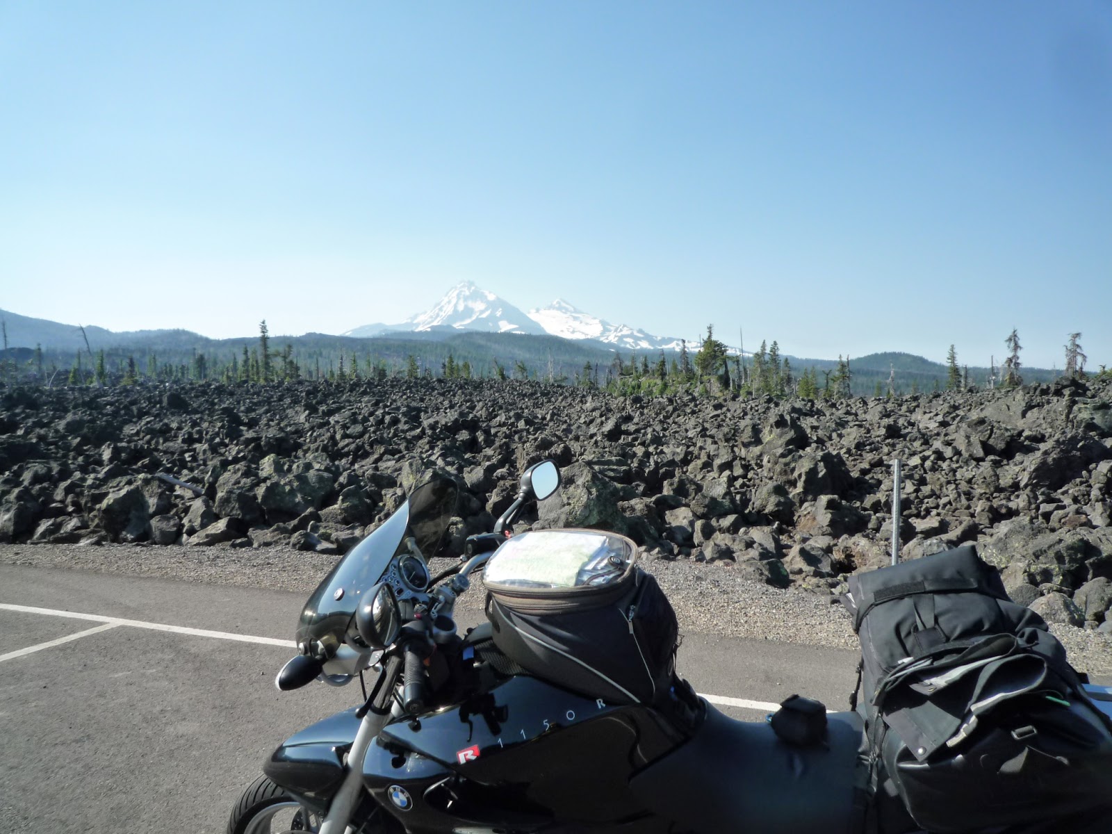
Tuesday morning was sunny but a bit cool at 60 degrees when I left the Blue River Lodge and headed east on highway 126. After 15 miles I turned right on 242, which goes over McKenzie Pass and is a beautiful, twisty, and delightful road through woods and over a rocky summit that compares to the roads over the Sierra in California, but without the traffic or the elevation - McKenzie Pass is only 5200 feet. I saw very few cars - maybe even more bicycles than cars.
The road ends in Sisters, where I stopped for breakfast at the Sisters Coffee House. Everything was gluten-free and organic, and everyone looked just a little too bright-eyed and healthy, but the eggs scramble was delicious, the house coffee was very good, and the staff was friendly. Dan would say that Sisters is entirely too precious, and that may be true - there was a surfeit of yarn shops, galleries, and craft stores. It looks like a retirement community for moderately wealthy people who are also very healthy. After breakfast I spoke with a bicyclist from LA who was on his way to New York. I am not worthy!
Picking up Route 126 in Sisters I rode east to Prineville, where I continued east on US 26 towards John Day. Unfortunately, I missed a sign warning of road closure ahead. It was one of those signs with blinking lights for letters that usually remind you to fasten your seatbelt, and I just caught a glimpse of it as I was passing a truck. Thirty miles up the road (very nice road, suspiciously non-existent traffic) I came to a roadblock. It seems there was a fire on the summit and the road was closed.
I went back to Prineville and headed north to Madras, where I went north on US 97 for 25 miles to Willowdale, where I turned on 293 to Antelope. From there I took 218 to Fossil and then 19 south back to 26. All of this added at least 150 miles to my day, but it was worth it because the small roads were a lot of fun and I'd never been on them before.The roads on my detour went over a couple of passes and they were in good shape, but there was gravel in some of the corners and enough tar snakes that you had to be alert, which is as it should be.
After dinner in John Day I rode another 80 miles on 26 and OR 7 (another twisty and beautiful road over a pass) to Baker City, OR, where I'm spending the night at the Oregon Trail Motel - $42 and breakfast at the restaurant is included. Tomorrow I'll ride into Hells Canyon and Idaho and up to US 12 over Lolo Pass to Missoula, MT, where I'm scheduled to have a new rear tire installed at the BMW dealer there on Thursday.
The long detour and hot weather (it was 95 degrees in the middle of the day) notwithstanding, it was a good day with great roads that I had mostly to myself.
| Looks like volcanic rock at the summit. |
The road ends in Sisters, where I stopped for breakfast at the Sisters Coffee House. Everything was gluten-free and organic, and everyone looked just a little too bright-eyed and healthy, but the eggs scramble was delicious, the house coffee was very good, and the staff was friendly. Dan would say that Sisters is entirely too precious, and that may be true - there was a surfeit of yarn shops, galleries, and craft stores. It looks like a retirement community for moderately wealthy people who are also very healthy. After breakfast I spoke with a bicyclist from LA who was on his way to New York. I am not worthy!
Picking up Route 126 in Sisters I rode east to Prineville, where I continued east on US 26 towards John Day. Unfortunately, I missed a sign warning of road closure ahead. It was one of those signs with blinking lights for letters that usually remind you to fasten your seatbelt, and I just caught a glimpse of it as I was passing a truck. Thirty miles up the road (very nice road, suspiciously non-existent traffic) I came to a roadblock. It seems there was a fire on the summit and the road was closed.
| Yep, the road is closed alright |
I went back to Prineville and headed north to Madras, where I went north on US 97 for 25 miles to Willowdale, where I turned on 293 to Antelope. From there I took 218 to Fossil and then 19 south back to 26. All of this added at least 150 miles to my day, but it was worth it because the small roads were a lot of fun and I'd never been on them before.The roads on my detour went over a couple of passes and they were in good shape, but there was gravel in some of the corners and enough tar snakes that you had to be alert, which is as it should be.
After dinner in John Day I rode another 80 miles on 26 and OR 7 (another twisty and beautiful road over a pass) to Baker City, OR, where I'm spending the night at the Oregon Trail Motel - $42 and breakfast at the restaurant is included. Tomorrow I'll ride into Hells Canyon and Idaho and up to US 12 over Lolo Pass to Missoula, MT, where I'm scheduled to have a new rear tire installed at the BMW dealer there on Thursday.
The long detour and hot weather (it was 95 degrees in the middle of the day) notwithstanding, it was a good day with great roads that I had mostly to myself.
| Victor poses in front of a fake town at a tourist stop in Mt. Vernon. It's a lot easier packing when you aren't camping. |
Monday, July 14, 2014
The Gang of Four Minus Three
"Plan your ride and ride your plan!" is a favorite saying among experienced, long distance motorcycle riders. This year's ride by The Gang of Four was originally built around the BMW rally in St. Paul, Minnesota. This seemed like a fun ride and a good fit for Dan, who lives in Illinois and therefore wouldn't have to ride halfway across the country to meet us as he has done in years past. Unfortunately, Dan will be busy giving a lecture on ancient medicine that weekend and would be unable to attend the rally. With that news the rest of us decided that we really weren't that interested in riding all the way to St. Paul for the rally, and so we worked out a route up the coast and across the northwest to the Black Hills and Badlands. I say "we" but John C. did the heavy lifting planning the route. Unfortunately (again) a few days before we were to leave John C. bowed out due to a persistent cough that he was afraid might be something serious. Two years ago Dan had to ship his bike and himself home from Anchorage, Alaska when a cough that he had wouldn't clear up, so John's caution was perfectly understandable. Now we are down to two.
John P. and I left from his house in Marin County on Sunday morning, July 13. We took US 101 to Cloverdale where we rode to the Mendocino Coast on CA 128. Traffic was light in our direction and we enjoyed the scenery and the twisty road. That far north on the Pacific Coast Highway (PCH - US 1) there wasn't much traffic, and we stopped in the town of Mendocino for a lunch break.While we were there John got a phone call from his wife, Celia. She'd stumbled on some stairs and she thought that she'd dislocated her ankle. When she called she was waiting for the ambulance to take her to the emergency room. John and I continued up the coast past Fort Bragg to Rockport, where the PCH turns inland to connect with 101 at Leggett. The ride along the coast was spectacular, and there was no traffic between the coast and Leggett, so we (well, I did anyway - John probably had other thoughts on his mind) were able to enjoy the twisty road. We stopped just before Leggett because John had heard from Celia. The X-ray showed that she'd broken a bone in her ankle joint, which was the cause of the dislocation, and she'd need surgery to repair the damage. John and I said our goodbyes - he wished me a safe trip, and I told him that Celia had my heartfelt sympathy. At 101 John headed south to look after Celia, and I went north to continue the ride as The Gang of One. (Update: Celia had surgery today, which involved a couple of pins, and she should go home tomorrow.)
The town of Rio Dell in Humboldt County has little to recommend it unless you have a particular interest in agricultural products of questionable legality. I checked into a motel there and spread out the maps to re-plan the ride. If I'd been on the Suzuki, I might have considered riding to Yellowknife in the Canadian Northwest Territories, which had been one of my thoughts for the summer ride. However, I was on my BMW, and BMW dealers are nonexistent in that part of Canada, so I decided to go back to the original plan of the BMW rally in St. Paul. I registered for the rally online and booked a motel room in St. Paul for two nights, and now I have a destination.
On Monday morning I woke to heavy fog, wet roads, and 55 degree temperature. I rode up 101 to Oregon, where the fog lifted and the day warmed up a bit. John C. advised me to ride the coast as far as Reedsport and turn inland to I-5 then continue east across central Oregon. The southern part of the Oregon coast isn't as spectacular as the northern California coast, but it is very scenic with wide beaches, rocky outcroppings in the water, and a well-maintained road. There wasn't nearly as much traffic as I'd feared, and there were plenty of places to pass. I rode past Gold Beach, stopped in Coos Bay for lunch, and five miles inland from Reedsport the temperature went up fifteen degrees. Highway 38 follows the Umpqua River and it is another scenic road with little traffic on that day and ample passing zones. I went north on I-5 and after a little jogging around in Creswell, I rode east on OR 126 along the McKenzie River to the town of Blue River, where I'm spending the night. Dining options are limited in Blue River, so I snacked on a turkey and cheese sandwich and a small watermelon. tomorrow I'll call a couple of BMW shops to find out when and where I can get a new rear tire.
John P. and I left from his house in Marin County on Sunday morning, July 13. We took US 101 to Cloverdale where we rode to the Mendocino Coast on CA 128. Traffic was light in our direction and we enjoyed the scenery and the twisty road. That far north on the Pacific Coast Highway (PCH - US 1) there wasn't much traffic, and we stopped in the town of Mendocino for a lunch break.While we were there John got a phone call from his wife, Celia. She'd stumbled on some stairs and she thought that she'd dislocated her ankle. When she called she was waiting for the ambulance to take her to the emergency room. John and I continued up the coast past Fort Bragg to Rockport, where the PCH turns inland to connect with 101 at Leggett. The ride along the coast was spectacular, and there was no traffic between the coast and Leggett, so we (well, I did anyway - John probably had other thoughts on his mind) were able to enjoy the twisty road. We stopped just before Leggett because John had heard from Celia. The X-ray showed that she'd broken a bone in her ankle joint, which was the cause of the dislocation, and she'd need surgery to repair the damage. John and I said our goodbyes - he wished me a safe trip, and I told him that Celia had my heartfelt sympathy. At 101 John headed south to look after Celia, and I went north to continue the ride as The Gang of One. (Update: Celia had surgery today, which involved a couple of pins, and she should go home tomorrow.)
The town of Rio Dell in Humboldt County has little to recommend it unless you have a particular interest in agricultural products of questionable legality. I checked into a motel there and spread out the maps to re-plan the ride. If I'd been on the Suzuki, I might have considered riding to Yellowknife in the Canadian Northwest Territories, which had been one of my thoughts for the summer ride. However, I was on my BMW, and BMW dealers are nonexistent in that part of Canada, so I decided to go back to the original plan of the BMW rally in St. Paul. I registered for the rally online and booked a motel room in St. Paul for two nights, and now I have a destination.
On Monday morning I woke to heavy fog, wet roads, and 55 degree temperature. I rode up 101 to Oregon, where the fog lifted and the day warmed up a bit. John C. advised me to ride the coast as far as Reedsport and turn inland to I-5 then continue east across central Oregon. The southern part of the Oregon coast isn't as spectacular as the northern California coast, but it is very scenic with wide beaches, rocky outcroppings in the water, and a well-maintained road. There wasn't nearly as much traffic as I'd feared, and there were plenty of places to pass. I rode past Gold Beach, stopped in Coos Bay for lunch, and five miles inland from Reedsport the temperature went up fifteen degrees. Highway 38 follows the Umpqua River and it is another scenic road with little traffic on that day and ample passing zones. I went north on I-5 and after a little jogging around in Creswell, I rode east on OR 126 along the McKenzie River to the town of Blue River, where I'm spending the night. Dining options are limited in Blue River, so I snacked on a turkey and cheese sandwich and a small watermelon. tomorrow I'll call a couple of BMW shops to find out when and where I can get a new rear tire.
| Covered bridge along the McKenzie River on OR 126 |
Tuesday, March 18, 2014
Walter - more dangerous than he looks!
Walter is a two-year-old mix from the SF Animal Shelter, who came to live with us in October of 2013. On New Year's Day we went to Stern Grove in San Francisco where he likes to play with other dogs. He was running around and chasing a dog, slammed into my leg at top speed, and broke my tibia just below my knee. I had to have surgery to repair the damage and I'm still on crutches while the knee heals. As a consequence of this unfortunate episode, I've been reading a lot and watching TV instead of taking advantage of this dry and warm California winter and riding my motorcycle, but I should be OK by summer riding season. However, I've also had time to update this blog with reports on a couple of trips I took in 2012 as well as an earlier trip in 2013 to the BMW MOA rally in Oregon. Check out the old posts if you are interested.
Subscribe to:
Posts (Atom)