
We stopped at the Yukon River motel/restaurant for breakfast.

At this point we are only 60 miles from the Arctic Circle, our destination for the trip. John had been as far as Coldfoot the year before, and he said that the road deteriorates after the Arctic Circle, although it isn't that bad. Beyond Coldfoot the road deteriorates as it climbs over the Richardson Range, and it can be a handful in wet weather

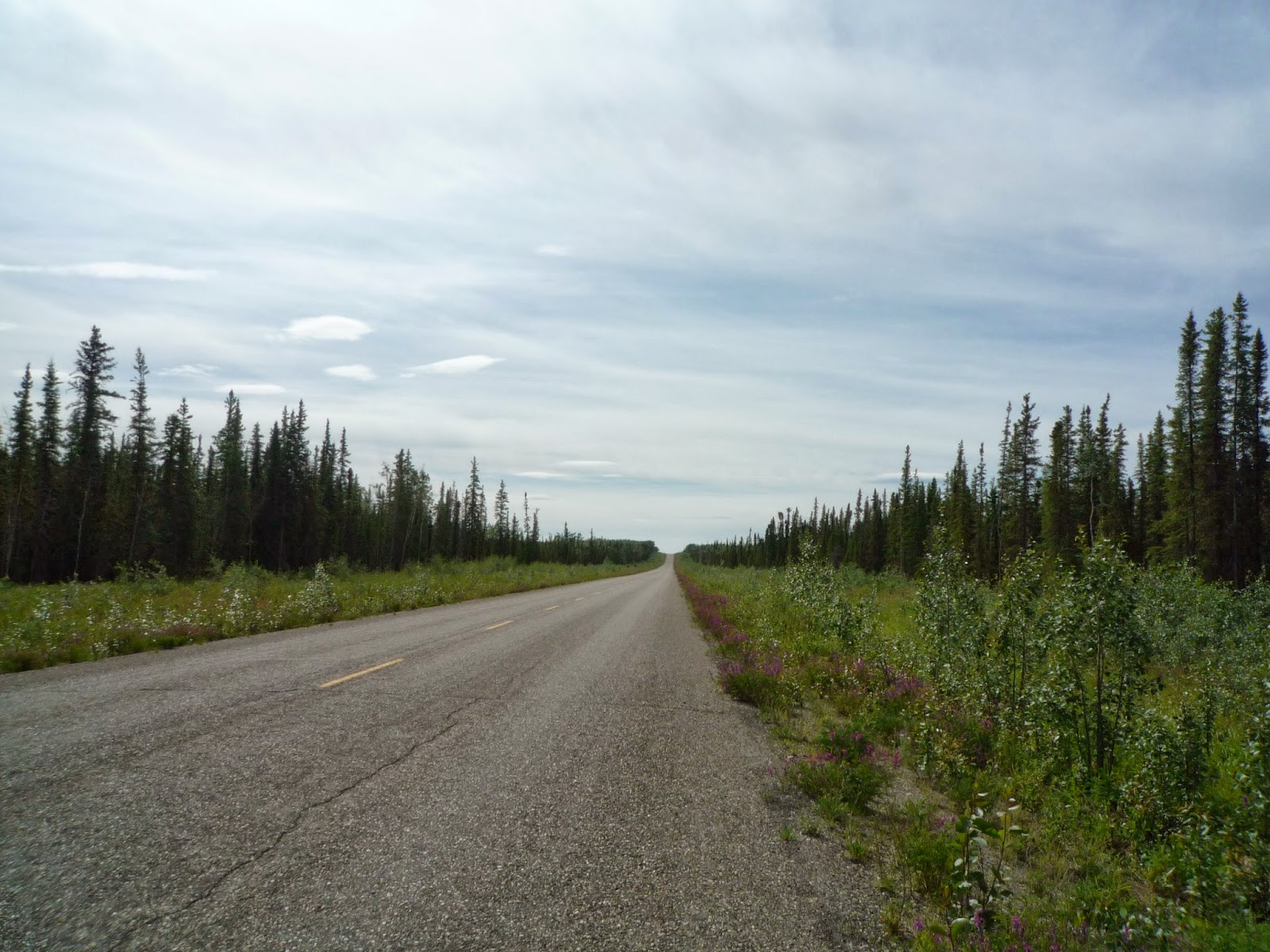
The scenery is pleasant rather than spectacular along the Dalton. In the distance you can see Needle Rock, a local landmark.

We took a few pictures at the little park at the Arctic Circle - there were rangers in a small, mosquito net enclosed station there who would give you information and snap your picture, as well as sign a certificate that showed you'd been there.

Riding back down the Dalton you can see the Alaska pipeline, which is the reason the road is there, from many places.

A few miles from the Yukon River we stopped for lunch at the Hot Spot, a small restaurant that is run by two women, who have a reputation for not suffering fools - well, for being cranky. They seemed to be quite pleasant when we were there.


We had lucked out with our weather since the Dalton wasn't slippery with mud, and also that because of the recent rain the road was not dusty - about the best conditions you can hope for. Since it was a Sunday, there wasn't a lot of truck traffic or active road construction. The next morning we stopped at Adventure Cycleworks in Fairbanks, where I had a new Heidenau K76 rear tire installed and an oil change, and John also had a new tire installed. It's kind of a funky, father and son shop, which is run out of the proprietor's garage, but we had appointments and were in and out of there in a couple of hours. The riding season in Alaska is only about four months, and the motorcycle shops probably get 90% of their yearly business during that short time. Many riders from the lower 48 ride up there and discover that after 5000 miles their tires are worn, so they call around and find out that the shops may not have what they need in stock, and even if they do they can't work on the bike for three days. John and I had both called many days before to schedule the appointment and to ensure that the tires we needed were available.
The weather was back to rain and cold and we rode south on AK 3, the George Parks Highway, and after an hour or so we stopped at Rose's Cafe for breakfast and to warm up.


The following day continued cold and damp as we rode by Denali, although the clouds parted occasionally to offer a view of the mountains.

We spent the night at a motel near the water in Anchorage and met John's brother and sister-in-law who were in town on vacation. Over dinner we discussed watching the Fourth of July fireworks, but when we discovered that they wouldn't begin until 2:30 AM - when it was finally dark - we decided against it.
The next day dawned gray with a few sprinkles, but it cleared up as we rode out of town and stopped at Jeannie's Java for coffee and rhubarb pie at the junction of AK 3 and Highway 1, the Glenn Highway.

The first time we stopped there (on a previous trip) I asked Jeannie where she got the rhubarb, and she pointed to a small vegetable garden near the road. We stayed on the Glenn Highway through Glennallen and skirted the Wrangel Mountains and spent the night in Tok, again at Fast Eddie's but this time in a cabin.
We were up early the next morning to a gray but dry day and we rode out of town and at Tetlin Junction turned onto the Taylor Highway (AK 3) and headed towards the town of Chicken. The 95 miles to Chicken is rough but paved, and there was little traffic.

We stopped at the Chicken Creek Cafe for a delicious breakfast. Chicken is an old mining town, now a tourist destination and part of the annual Dust to Dawson motorcycle rally.

After Chicken the road is unpaved, and the weather began clouding up and by the time we reached the Yukon border it was raining again. By this time the Wee was showing the effects of the mud riding.

Border formalities over, we rode unpaved Canada Highway 9, the Top of the World Highway, towards Dawson City.

We were quite isolated in the beautiful scenery.

We took a free ferry across the Yukon River. At this point the river is moving swiftly, and the captain steers sharply upstream and lets the current carry him downstream to the landing on the other side.

Once over the river we rode on paved Highway 2, the Klondike Highway, for 25 miles into Dawson City, where we booked rooms at the Downtown Hotel.

Except for Highway 2, the streets of Dawson City are unpaved. The town has been rebuilt and preserved, but retains some of the flavor of the Klondike gold rush days.

We spent an interesting hour at a self-directed museum that has letters, artifacts, photographs, and newspaper clippings from the gold rush and mining days. The Honda Gold Wing in the picture below is an example of how not to pack. Not only do you not want weight hanging way off the back of the bike, the stuff there will get incredibly muddy if the weather is wet, although I suppose that it might provide a good cushion in case of a rear end collision.

The next morning we rode down the Klondike Highway, Highway 2, and had breakfast at the Moose Creek Lodge.

The road is in good shape and was mostly deserted on that day. It goes along the Yukon River, and I learned from a sign at a turnout that during the gold rush the steamboats would burn through 120 cords of wood going from Whitehorse to Dawson City.

In Whitehorse we joined the Alcan again and spent the night at a lodge outside of Teslin, and the next morning we were up early to greet a cold and drizzly day. We knew from the ride up the Alcan that many service areas for gas, food, and lodging along the way had closed since the last time we were there, so we made a point to stop at Rancheria and spent an hour there having breakfast and warming up. The parking lot looked like the scene at a motorcycle rally.

A hundred miles later John went south on Highway 37, the Cassiar, and I continued on the Alcan. John was going to meet a friend of ours in California and ride around for a few days, while I intended to ride across Canada to Hudson Bay.
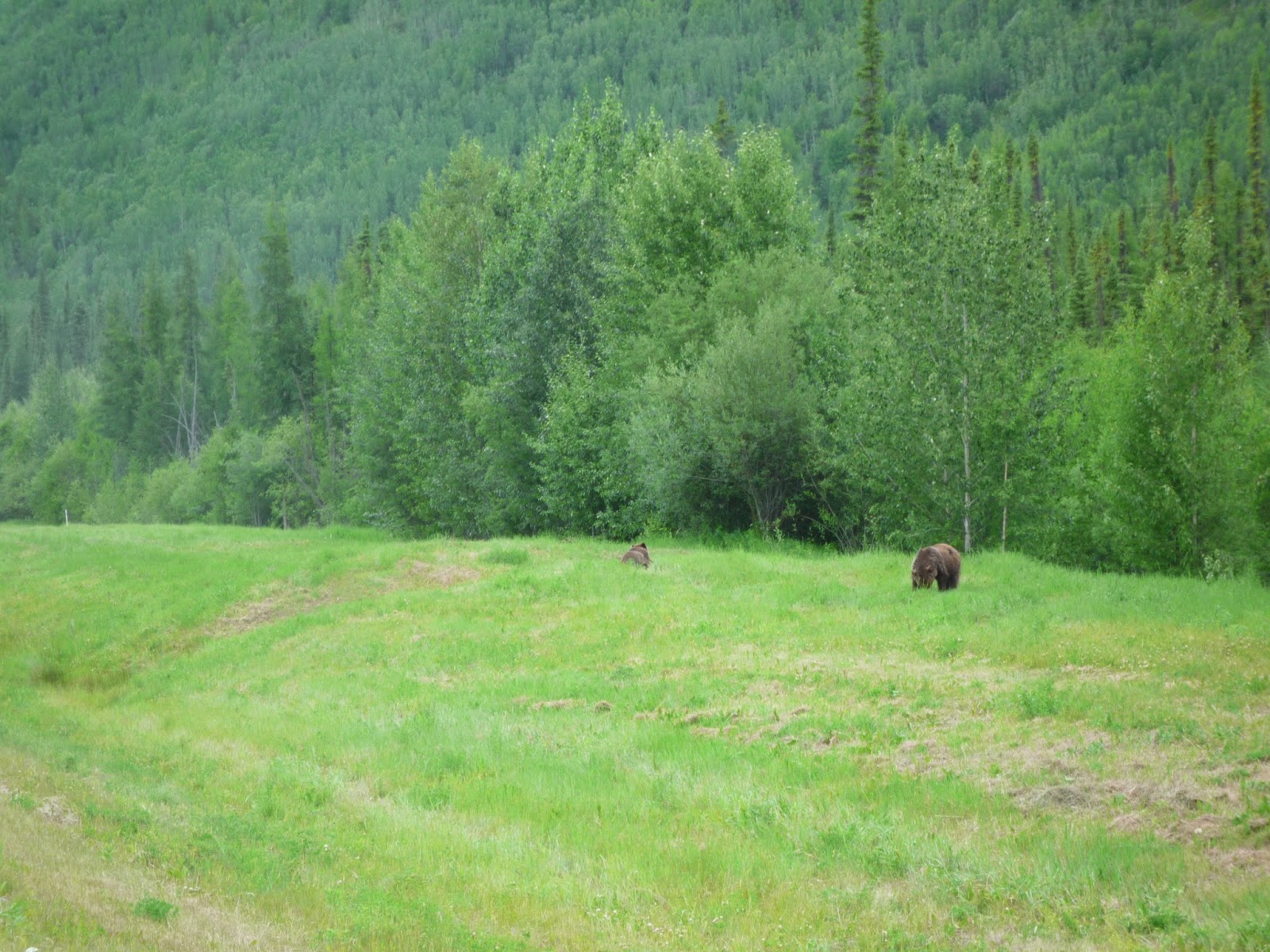
The area along the Liard River is know for its wildlife, and it isn't unusual to see bears, mountain sheep, and buffalo along or even on the road. When I stopped for gas in Liard River I mentioned seeing the Grizzly bear and the cub, and the woman said that it was part of a family of three (mom and two cubs) and well known in the area.

I rode over Muncho Pass and by Kluane Lake, and in contrast to the previous two times I'd been there, the weather was quite decent.

It's a fine curvy ride once over the pass, but I spotted a couple of motorcycles along the road, and one on its side in the ditch. The bike had a trailer attached, and the rider appeared to be injured, but not seriously. He and his wife were part of a small group, and someone had already gone into Toad Crossing to get help. I stayed around until an ambulance came. The other riders were going to wait for a truck to pick up the bike. I spent the night at the motel in Toad Creek, where I'd stayed a couple of years ago. The next morning I had a conversation with an older guy (like me) on a Suzuki DL650, like mine. He had most of the same modifications on his bike that I'd made to mine. He was from Oklahoma and headed home, and we both agreed that the Wee was a fine bike for solo touring.
I stopped for breakfast in Fort Nelson at the Coffee 'n' Crumbs cafe, where I'd been to on previous trips with my friends. The place used to be called the Rocky Mountain Cafe, but it was still owned by the same woman. She recognized me and asked where my traveling companions were.

The weather continued to improve as I rode to Dawson Creek and the terminus of the Alcan Highway. I took Highway 64 out of Dawson Creek and into Alberta, and spent the night in Dunvegan. I had dinner at a Chinese buffet restaurant with a Scandinavian name, and the next morning rode on Highway 2 through Peace River and suddenly I was in the Canadian plains with miles of canola (rapeseed) fields on either side of the road.

I had breakfast late the next morning at a restaurant in Slave Lake, where the picture below was on the wall.

It is titled Destiny Highway - I can only assume that James Dean, Marilyn Monroe, Humphrey Bogart have a universal appeal.
Not far out of Slave Lake I turned on Highway 55 and rode through Athabasca and continued on that road across the plains. Apparently, many Ukranians had settled in that part of Canada and several towns featured large, Orthodox churches.

No comments:
Post a Comment