
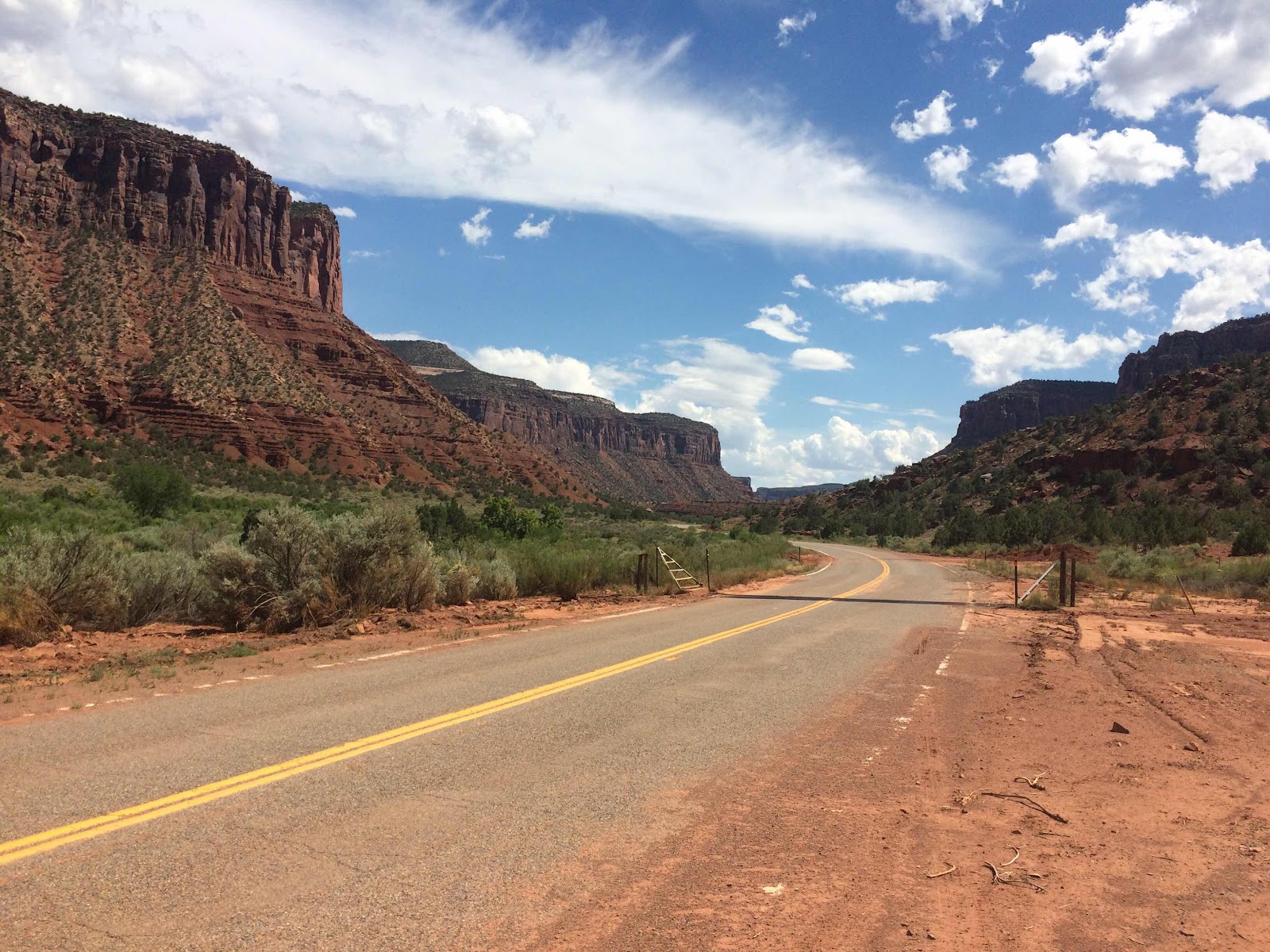
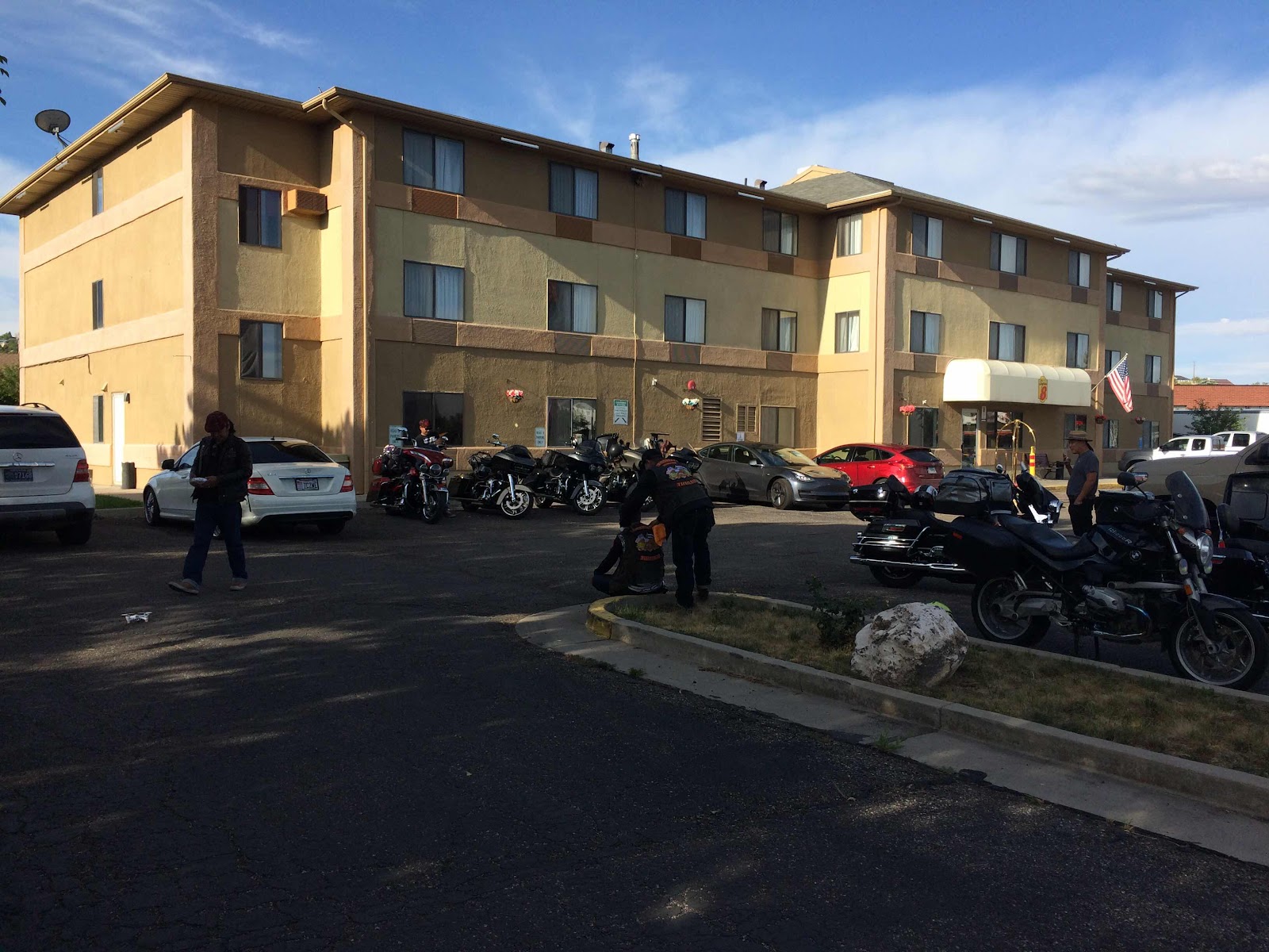
(Tuesday, July 23, 2019)
Nikki and I left at 11:45 this morning and immediately hit slow traffic on Park Prsidio due to road construction. After that it was a smooth and quick ride over the Golden Gate bridge to 101 to Highway 37 to I-80, I-505 and I-5. We stopped in Williams for lunch at Granzella’s, had one more stop for gas in Red Bluff, and checked into the Thunderbird Lodge in downtown Redding at 4:45. The weather was cool until we were east of Vallejo where it was a pleasant 80-85, and then by I-505 it was 90 and in Redding it is 101. Hot but not unpleasant for me as long as we are moving. Nikki, behind me and out of the wind has a different opinion.
Nikki here! I’ll be making comments along the way as I see fit.
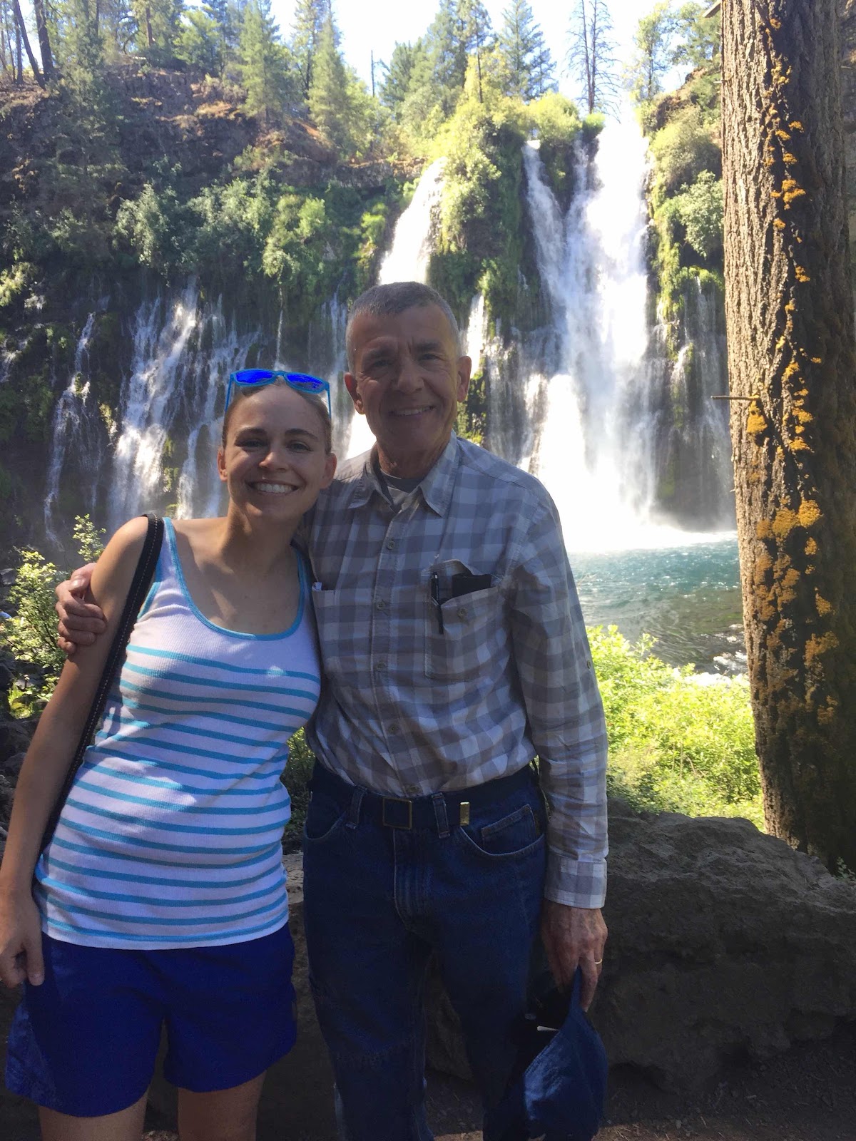
Nikki and I walked to the Sundial Bridge (about a half hour), which was designed by Santiago Calatrava, cost 24 million dollars, and was completed in 2004. Andrew and I visited there in 2004 and the Turtle Bay Park area around the bridge wasn’t completed then.

232 miles today.
(Wednesday, July 24, 2019) After breakfast at the motel we were on the road by 9 and after wandering around downtown Redding for a few blocks managed to get out of town and head east on US 299. After an hour we stopped at Burney Falls State Park where we camped a long time ago when the kids were very small. Nikki and I walked down a short trail to the bottom of the falls and after an ice cream at the general store at the park were back on the road.

We continued on 299 over a couple of 5000 foot passes to Alturas, where we got fuel and had lunch. There was one section of road construction that held us up - to be expected in the summer. We went north on US 395 by Goose Lake into Oregon and through the small town of Lakeview where a sign warned of congestion. Oregon must have a different definition of congestion than San Francisco. After Lakeview there was nothing but open range and rolling hills for 90 miles. The elevation was 3500 to 4000 feet and the temperature was around 85 so it was a very pleasant day. We went east on US 20 at Riley and immediately hit more road construction, which lasted almost to Burns, where we are spending the night at the Silver Spur motel. Dinner was at the Pine Room in town, and the portions were huge - I’ll have to order accordingly in the future. (358 miles)
(Thursday, July 25, 2019) We were on the road before 8 this morning heading east on US 20 out of Burns. It was a sunny day (and would remain so throughout the day) but a bit chilly at 65 degrees - neither Nikki nor I were wearing a sweatshirt although I did have on my warm gloves. We rode over Stinkingwater Pass (4800 feet) and Drinkingwater Pass (4200 feet) and after 60 miles of pleasant and hilly road we stopped in Juntura at the Oasis Cafe for breakfast. An hour later when we were on the road again it had warmed up to 75 and eventually climbed to 85 - pleasant weather all day. We stayed on US 20 to Vale, where the Bates Motel sign is still standing, althouh I’m not sure there is an actual motel there any longer.

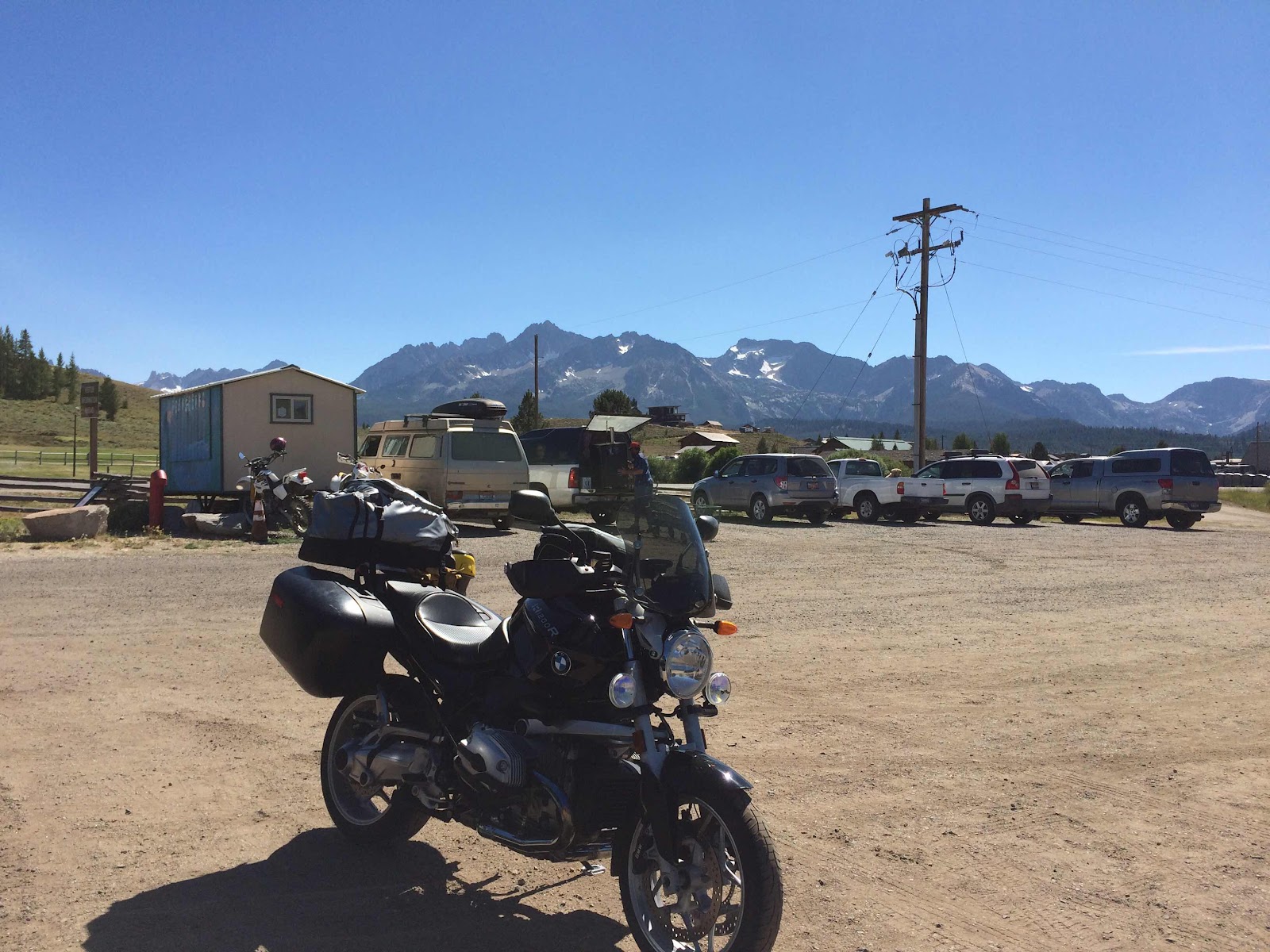
We stayed on 20 to US 30 and went north a bit to Ontario where we crossed the Snake River into Idaho and went south on I-84 for a couple of miles to Fruitland where we stopped for gas and Nikki spotted someone selling Border Collie puppies for $75 - good thing we were on the bike and not in a car. We went east on Idaho 52 and then followed the GPS on a strange farm roads shortcut back to 52 again and then north on Idaho 55 at Horseshoe Bend to Banks and east on County 24 towards Lowman. There was a brief stop for road construction and a lot of backed up traffic - the road has many access points for river rafters and we could see the swiftly flowing river from the road for the next 30 miles. After about 10 miles the traffic cleared and we had an enjoyable ride on the twisty and hilly road, although I had to play close attention to the surface instead of the scenery - lots of broken pavement and tar snakes. We stopped for a quick drink in Lowman at the one store/gas station and went north on Idaho 21 to Stanley. The road had some traffic, but there were plenty of places to pass and I rarely used fourth gear - mostly fifth and sixth. The highest point was 7000 feet and there was a fire in the area - we could smell smoke and see fire trucks parked at various places. Stanley was bustling and we got gas and had something to drink (coffee for me) and oatmeal/raisin cookies in lieu of lunch since it was 4:30 in the afternoon. The Sawtooth Mountains make a dramatic sight from the parking lot at the coffee bar..
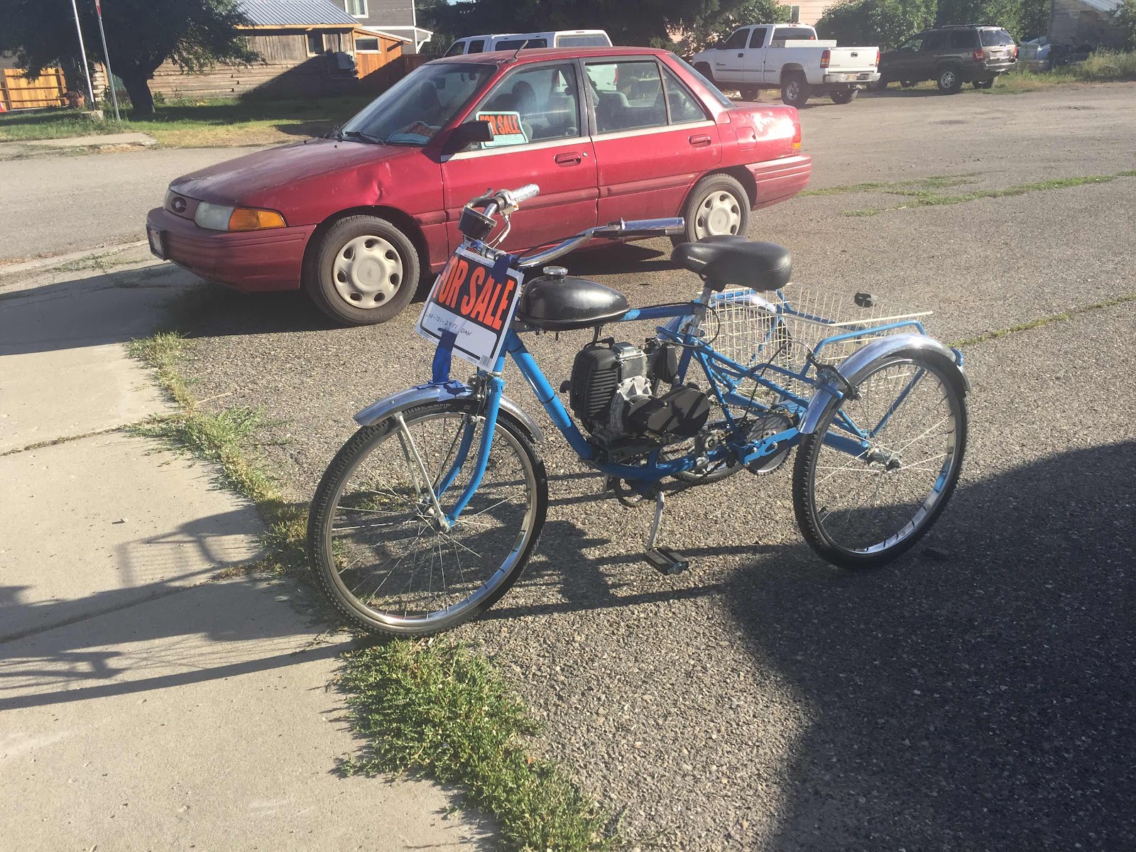
We rode south through the Sawtooth Range on Idaho 75 over 9000 foot Galena Summit and into Ketchum. The road was in good shape, there was little traffic, and scenery was spectacular. At one point I had to break for a young moose that decided to cross the road, but there was a large clear area on either side of the road so I saw him/her in plenty of time. As we neared Ketchum the ubiquitous Ford F-150 and Chevy Silverado pickups were replaced by Range Rovers and Porsche Cayennes with the occasional Mercedes and Audi Q7. Ketchum was busy, and the 20 miles from Ketchum to Bellevue was a bit of a slog, although it was fun to ride by the Haley airport and see the Gulfstreams lined up - there were at least a dozen. Bellevue is the working class area of the Sun Valley, and our motel, the High Country Inn, is an old fashioned place but comfortable enough. On our way to dinner at the Mama Inez restaurant we saw this powered tricycle with a basket that Nikki thought would be perfect for traveling with a small dog.
Tomorrow should be a short day with more stops than today. (371 miles)
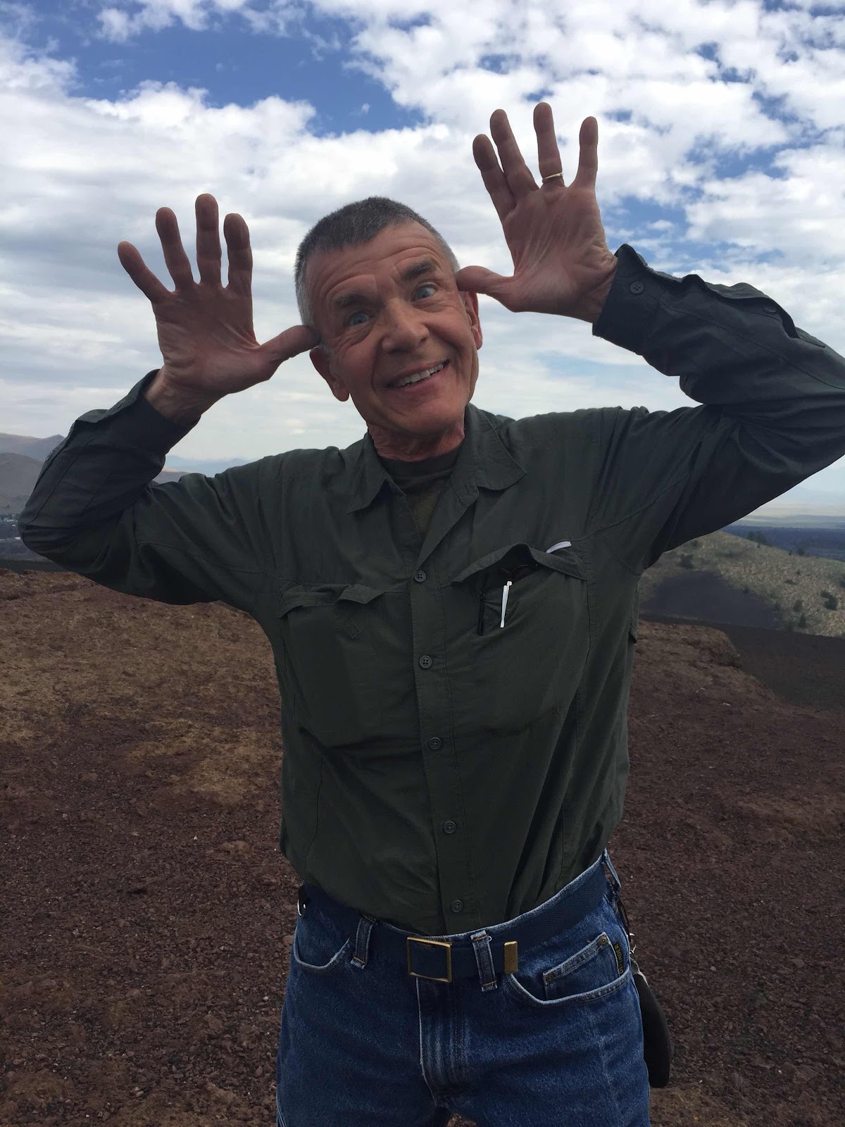
(Friday, July 26) Today was going to be a short day, so we were in no rush to leave the motel early. At a little before 9 we went north for half a mile to Brandie’s Country Kitchen and had an excellent breakfast after which we rode back through Bellevue and then took a short cutoff through Gannett to US 20 where we rode east through Picabo (where I once camped at an RV park) and Carey and then turned into Craters of the Moon National Monument. At the visitor’s center we asked a ranger for a recommendation for a couple of highlights on the 12 mile loop. Map in hand we went back to the bike and after a couple of miles stopped at Inferno Cone and walked a short distance to the cone.

Dad neglected to post the BEST photo from Inferno Cone... here it is for your viewing pleasure.
And then rode a short distance to the Big Crater.

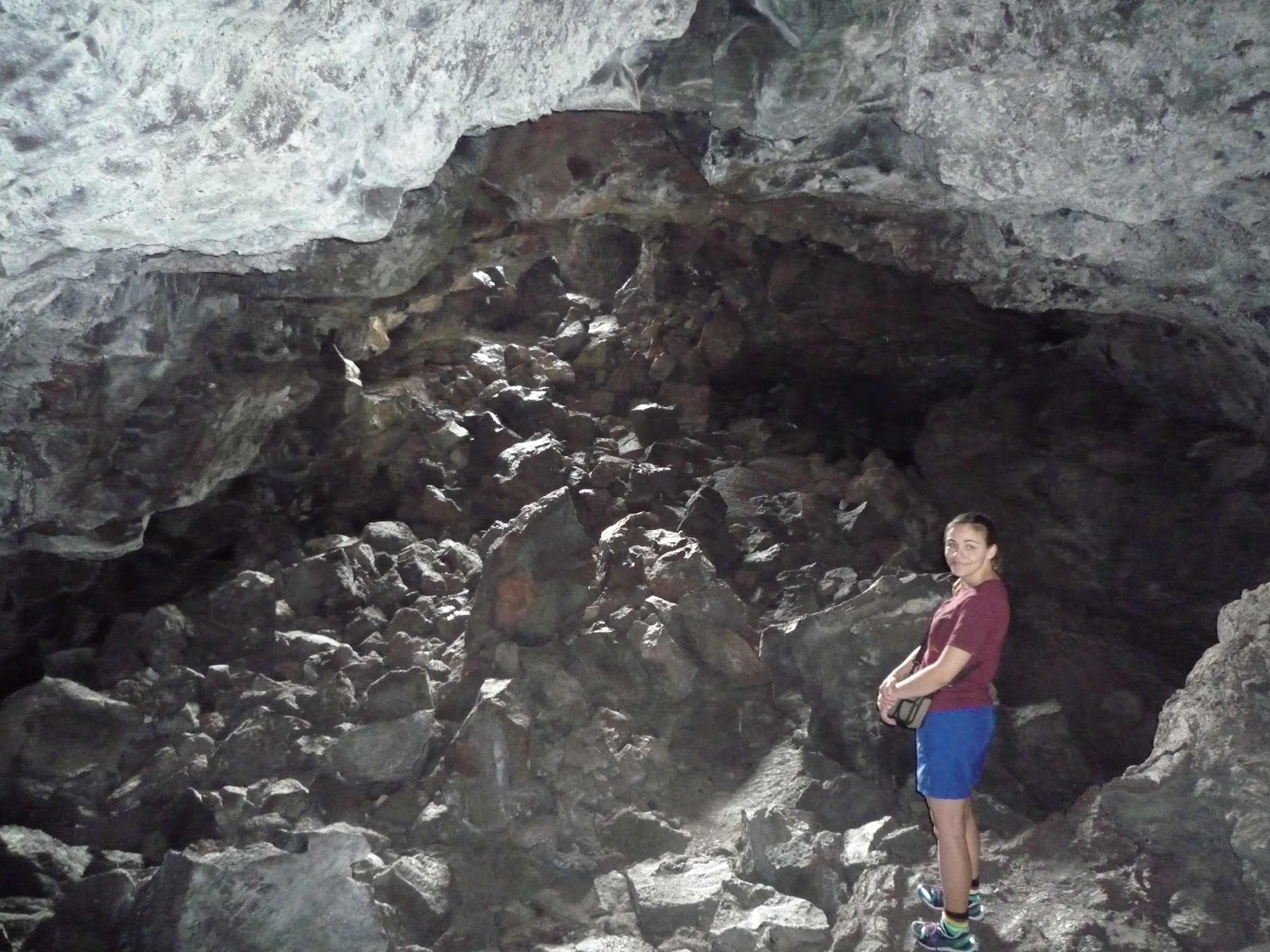
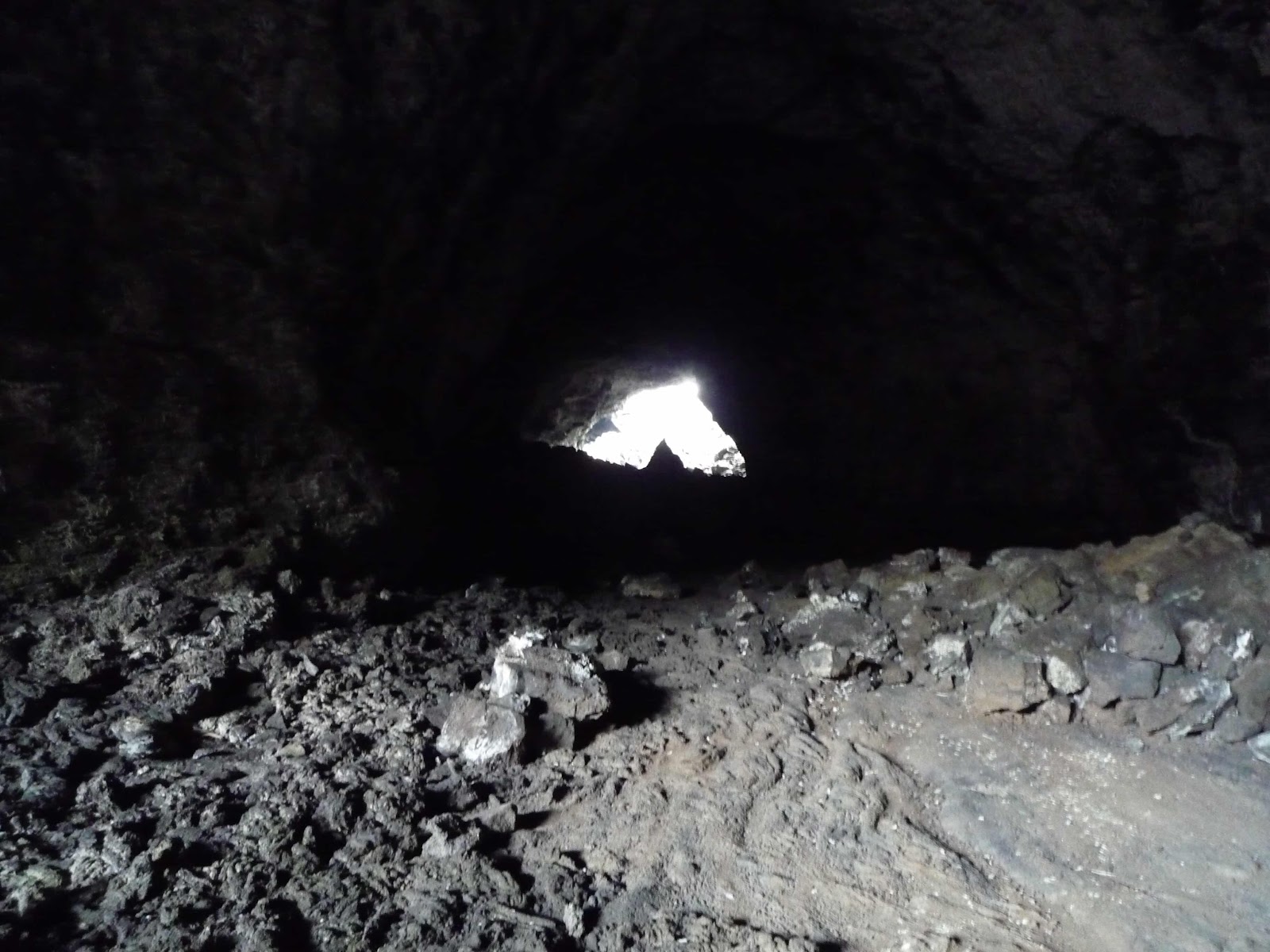
We rode a couple of miles to the cave area and hiked .8 mile to the cave area and Indian Tunnel, which we hiked through. It was a bit of a test for my new hip as we were climbing over rocks on uneven ground, but I managed without too many complaints from me. I was very glad Dad made it... I would have never heard the end of it if he fell on my watch!


Hiking and climbing done for the day we rode back to the visitor’s center to wash up and got back on the road. We made a quick stop for gas in Arco (Mobil premium no alcohol!) and went 20 miles to EBR-1, the first nuclear power plant which went up in 1951. I’d been there before and it is a fascinating place - the machinery and control rooms look like a science fiction set from the 1950s, which makes sense I suppose. Nikki found a friend in one of the control rooms.

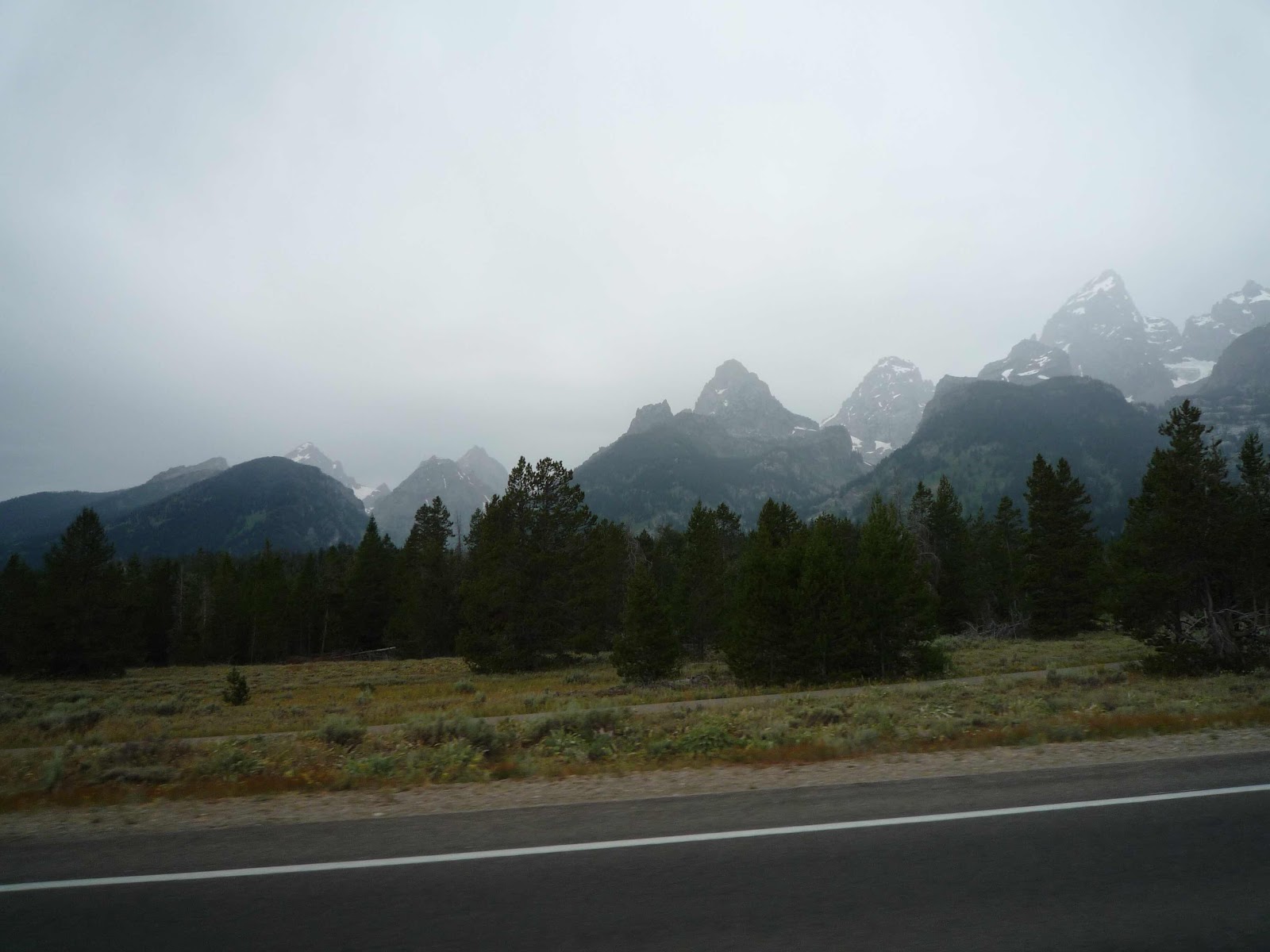
The weather had been overcast all day, which was very nice when we were hiking around Craters of the Moon - the other two times I was there it was 95 degrees, but today it was 80-85. There were even a few sprinkles, but when we left EBR-1 it was sunny and 85. I followed the GPS to Idaho Falls and from the overpass we could see a huge backup exiting I-15 to US 20, which we were on. We stopped in Rigby for coffee and quick bite and continued on US 20 to ID 33. The road is very pleasant through ranch and farm country - potatoes, I think - and we were at 5-6000 feet of elevation. We had our first view of the Tetons in the distance, which always make me think of the way little kids draw mountains - very steep with jagged peaks. We came into Driggs and I pulled into the Super 8 where I had a reservation, I thought. Unfortunately, my reservation was for the previous night, but there was one room left, so I grabbed that. An expensive mistake on my part. This is a prime vacation area in the middle of summer, so we were lucky to get the room, which is quite nice with lots of space to spread out all our stuff, and there is a swimming pool and jacuzzi (which Nikki used) and a laundry which I’m currently using. (221 miles)
(Saturday, July 27) Today was Yellowstone! We had breakfast at the motel and left before 9 dressed for rain, and in fact it did rain off and on until noon. I stopped for gas and on the way to Teton Pass road we had a good view of the mountains.

We rode up Teton Pass to Jackson, where we stopped at the Visitor’s Center to make a couple of phone calls regarding Nikki’s Honda, which was in the shop. Leaving Jackson for Yellowstone, we were diverted through Teton National Park because there was road construction ahead with half hour delays. (This meant that we had to wait in a long line at two park entrances.) However, it is a nice ride through the park, and we rejoined the main highway north of Moran and continued into Yellowstone. There was traffic, but not too bad and it moved along at the (low) speed limit. We parked near the Old Faithful Inn and had lunch and then walked over to the geyser viewing area, which was already packed with people.

Right on schedule, the geyser did its thing.

The whole area around Old Faithful is filled with small geyser pools, and that continued north as we headed to Norris junction.

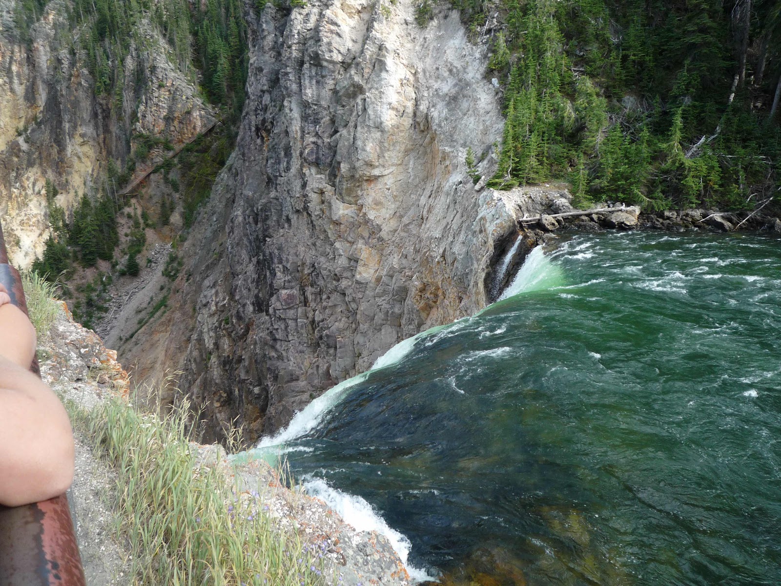
We went east to Canyon where we parked and hiked down a trail to the lower falls.

Leaving Canyon we rode north and then east through the lovely Lamar Valley.

Nikki took many pictures from the back of the bike as we rode through the park.

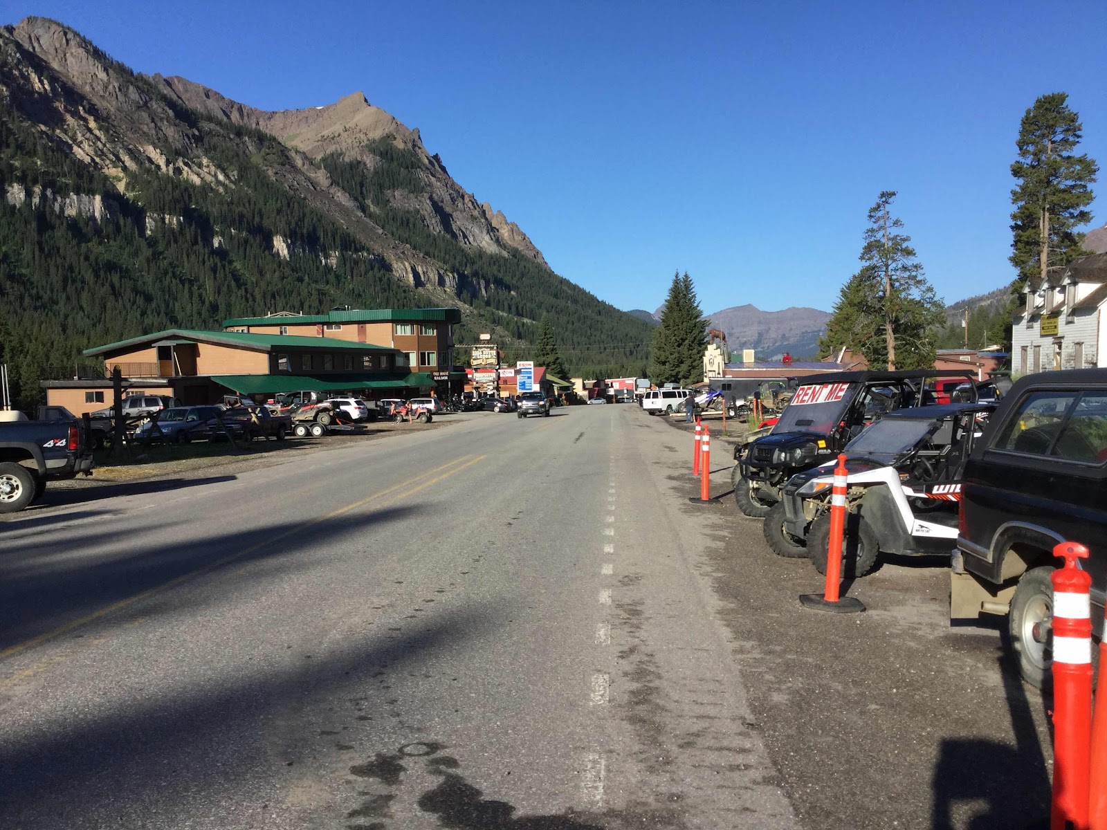
We exited the park at East Gate, rode through the small town of Silverlake and in a couple of miles came into Cooke City, where we spent the night at a very rustic motel. There’s no cell service in Cooke City, and one ISP for the whole town, so the Wi-Fi was very slow, which is why this entry is a day late. The lack of modern technology notwithstanding, Cooke City is a great place - very friendly people, laid back, and good restaurants. After walking around town, we had dinner at the Beartooth restaurant, and when we left it had started raining, so we hustled the couple of hundred yards to the Alpine Motel. (233 miles)
(Sunday, July 27) Today was a great riding day, marred by one minor incident about which more later. We were up early and had breakfast at the Bear Claw Cafe and were seated with Jill and Jeff, retired teachers from a town near Missoula. When I expressed my enthusiasm for Cooke City, Jeff reminded me that Hemingway spent a lot of time there in the 1930s.
When we left the motel at a quarter to 9 it was 55 degrees and sunny and we headed east on Beartooth Highway past the cutoff for the Chief Joseph Highway and up into the Beartooth Mountains. There was very little traffic that time of day headed east and we enjoyed the curves and scenery. We made a stop at the top of the pass (10,900 feet and 45 degrees) and spoke with a group of motorcyclist from Ontario. We made one other stop at an official rest area between the summit and Red Lodge.


We stopped for gas in Red Lodge, Montana where it was a balmy 75 degree and we shed our overpants and sweaters and switched to lighter gloved. We rode on Montana 130 to US 120 and into Cody, where we had lunch at Peter’s cafe. By now it had warmed up to 85 and the elevation was 4500 to 5000 feet. Except for the 10 miles or so of Wind River Canyon, this part of Wyoming is rather boring.

About 30 miles west of Casper we passed a couple of motorcycles that were parked off the road down an incline. I waved, and they waved back, but after a mile I thought that it was an odd place to park, especially since we had passed a rest area about two miles before, so I turned around and went back to see if they needed some help. Unfortunately, when I attempted to park on the narrow shoulder I didn’t realize that the shoulder had a steeper incline than I thought, and when I put my right foot down to balance the bike, the bike toppled over and Nikki and I went tumbling off the bike. The two guys quickly asked if we were OK, and then righted the bike before I even had a chance to help. I moved the bike to the other side of the road (where the shoulder was level, and assessed the damage. Nikki has a bruised knee, the bike has a few scrapes on the right pannier, cylinder guards, and hand guards, and the straps for the front of the tail bag tore off. Fortunately, there are two straps on the other side that worked just as well, so I flipped the bad around. It turned out that the older of the two had a flat tire, but it was too badly gashed to repair with a plug - like me, he had an air compressor and tire plugs. They were from Casper and had called a friend with a truck to come pick them up. We got back on the road and were soon in Casper without further incident. The moral is to always be conscious of your footing when you stop the bike! (350 miles)
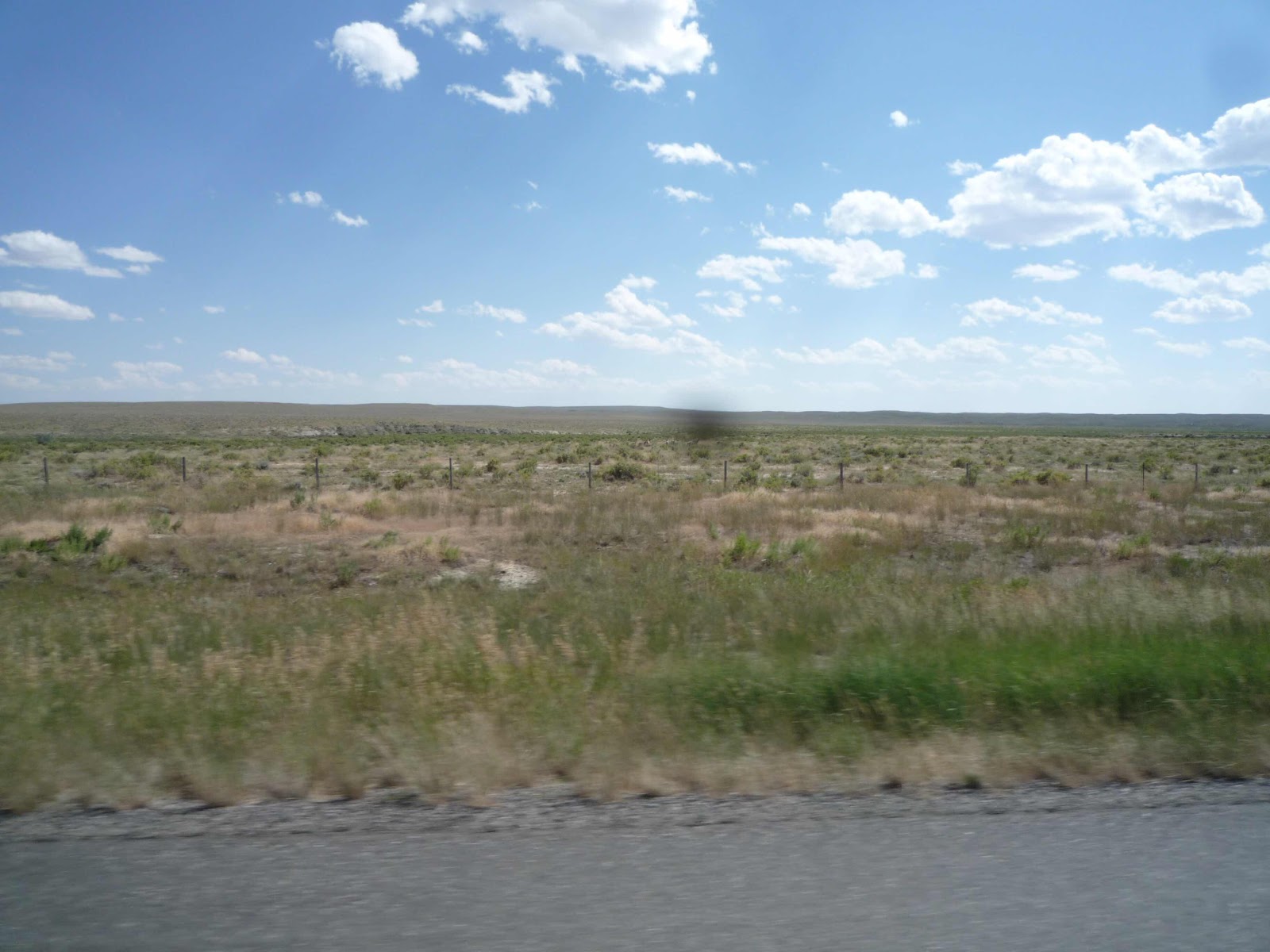
(Monday, July 29, 2019) We had a short day planned with no stops except for gas and food, so we didn’t leave the motel La Quinta until almost 10. We followed the GPS WY 220 out of town to to the southwest and then WY 487 to the southeast to Medicine Bow and the US 287 to Rock River and Laramie where we stopped at Grounds Cafe for lunch. Laramie is still an old and quaint small town in spite of being the site of the University of Wyoming - none of the overgrowth that I’ve seen in places like Boise and Idaho Falls. We continued on US 287 into Colorado and went east on CO 14 into Fort Collins. It was about 70 when we left Casper and 75-80 all the way to Laramie. The elevation was between 6500 and 7500 feet until Fort Collins where it dropped to 5500 feet and the temperature went up to 85. Except for a river in Casper the scenery was of barren ranch land with some hills in the distance and no curves.

If you are heading east on I-80 and want to go to Denver, US 287 cuts off a few miles as the hypotenuse of an isosceles triangle with Laramie, Cheyenne, and Fort Collins. As such it is fairly heavily traveled, but we maintained 70 mph all the way and passed few cars or trucks. Fort Collins is another once charming town that has grown too rapidly, but the heavy road construction of the last several years seem to be almost complete. I-25 south to Denver is still being widened for about 20 miles south of Fort Collins, so traffic moves at 75 mph for 5 minutes, then slows to 40, then stops, then goes back up to 75. We exited at the Northwest Toll Road, which cost $4 for about 5 miles and were soon on US 36 and then in Boulder where I checked into the Rodeway Inn Brokers, where I’ve stayed several times before. Nikki will be staying with Rocky and Vanya at Vanya’s apartment a few miles away. It was only 4:30 so Nikki and I went to a nearby supermarket, Sprouts, and bought some fruit and other items. Vanya and Rocky picked us up at Brokers and we went to the west side of town past Chataqua park and went for a hike up to Saddleback. The hike was only a little over a mile, but it was quite steep and rocky, and we even had to climb a ladder at one point. On the other hand quite a few trail runners came down as we were going up and Vanya explained that runners use the trail as a training ground. At the top we had a great view of Boulder with Chataqua park in the center and way to the east the plains begin.
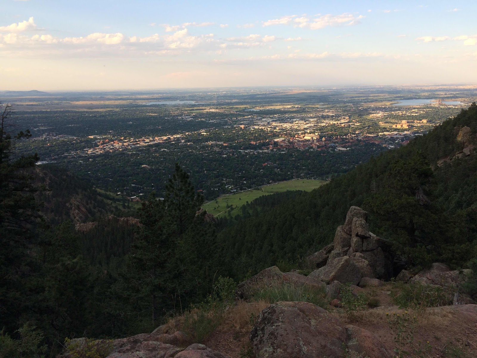
The end of the hike was a rocky point that overlooks Boulder to the east and more mountains to the north and west. Rocky seems to be enjoying the view, or maybe he knows that the climbing is finally over.


It was just sunset by the time we returned to the car and drove back to the Broker. Vanya went home to feed Rocky and shower, Nikki and I showered and I went out for pizza (Cosmo’s - about 50 yards from the hotel) and the Vanya joined us at the hotel. Tomorrow Nikki and I will get together in the morning and look around Pearl Street in downtown Boulder, and then have dinner with Jon and Liz, Carol’s brother-in-law and sister. (281 miles)
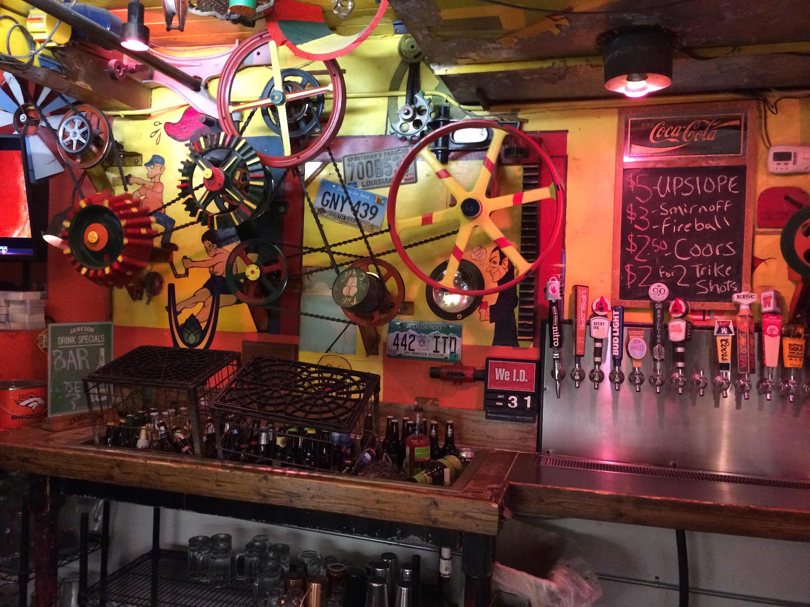
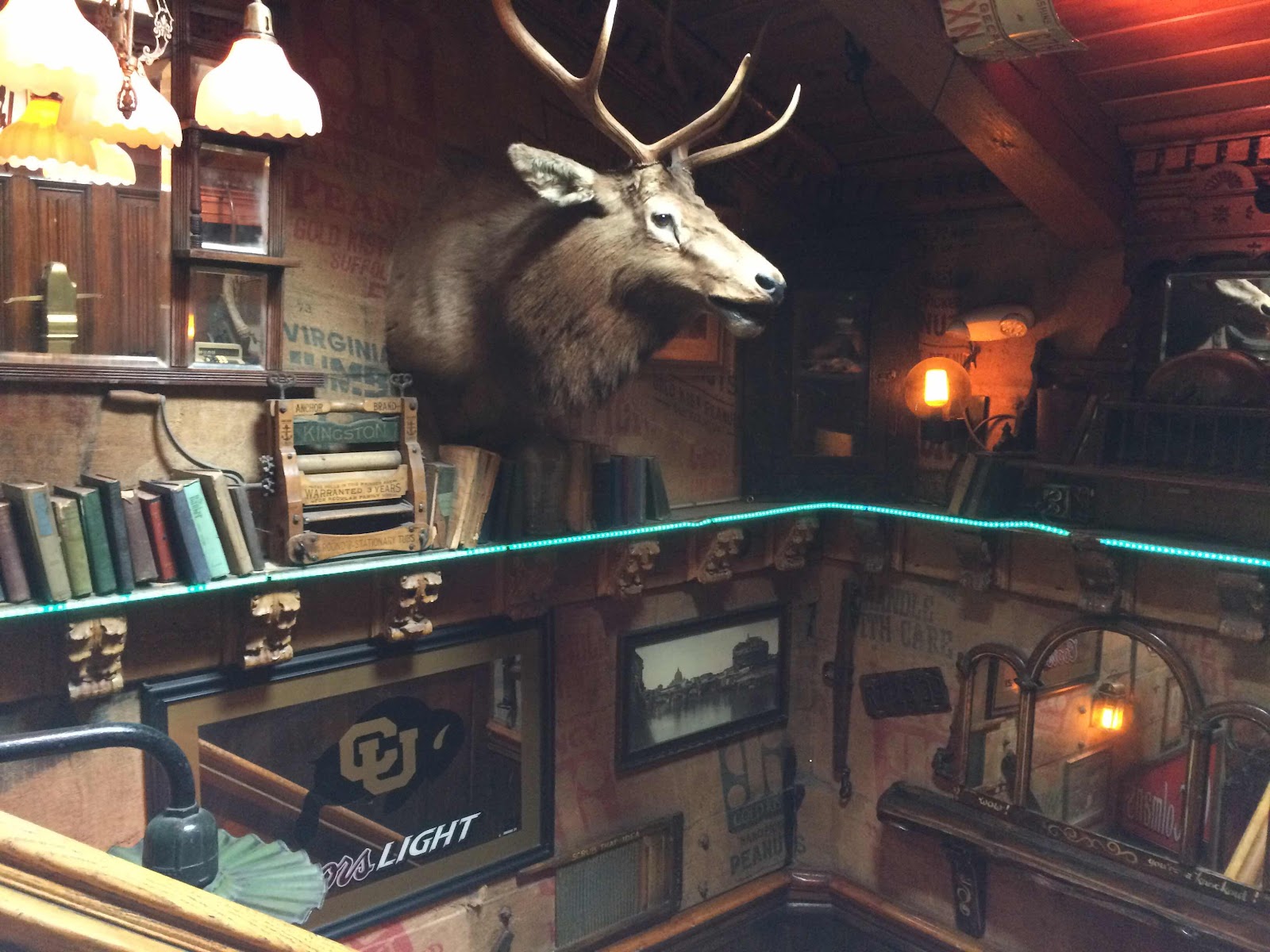
(Wednesday, July 31, 2019) Nikki had lunch with Jon and Liz today and hung out with Rocky and I rode to BMW of Denver in Centennial (about an hour south and east of Boulder) for two new tires. Everything went smoothly and back at the hotel I did a laundry and had a late lunch at the Dark Horse, a pub near the restaurant that is also a student hangout. The place is huge with bars upstairs and down, and every kind of decoration and stuff hanging on the walls that you can imagine.
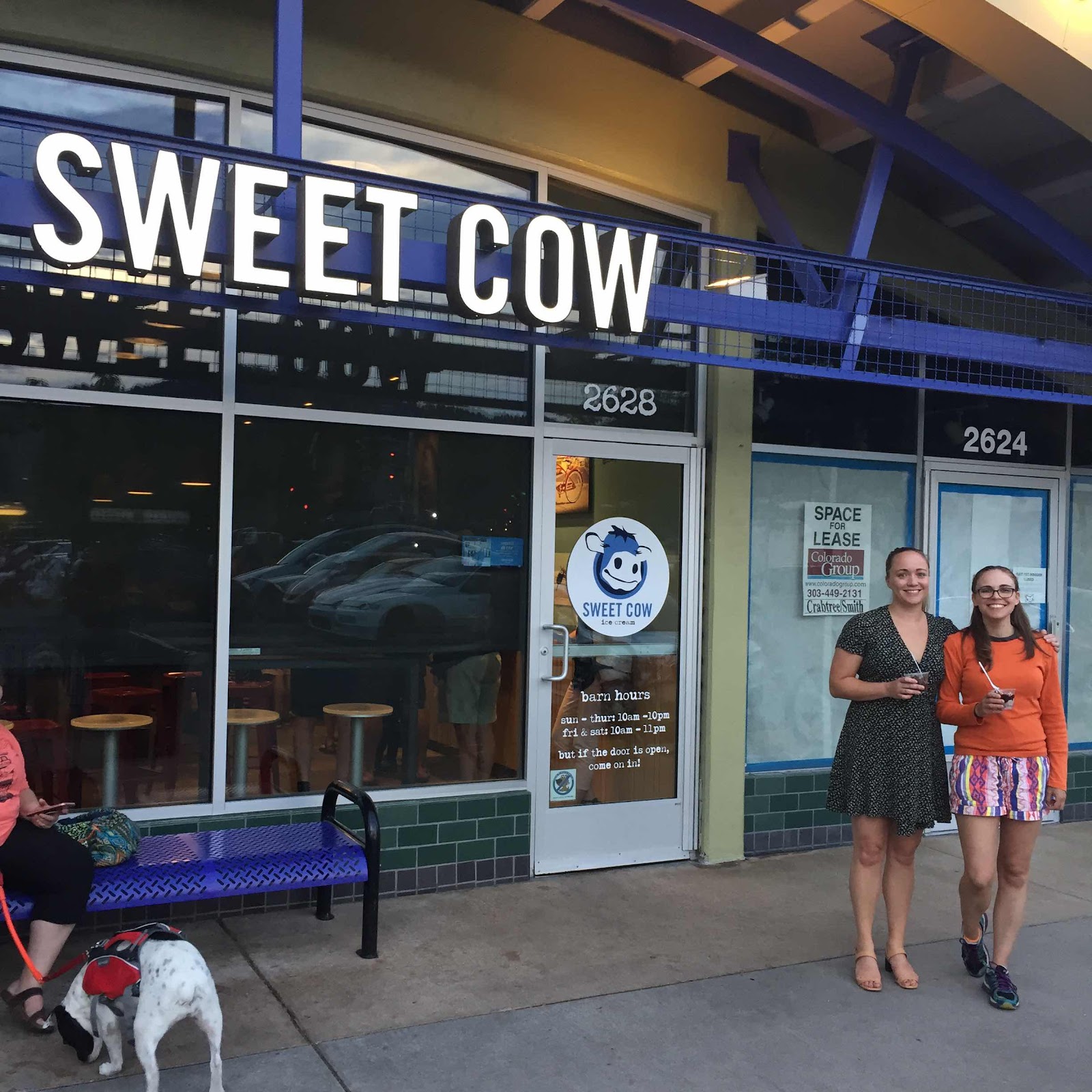
I rode over to Vanya’s place where Nikki and Vanya and I had dinner at Santo, a nearby Mexican restaurant after which we had ice cream at Sweet Cow, a Boulder area institution.
I won’t leave until mid-morning tomorrow so as to avoid traffic going into Denver. (100 miles to Centennial and back)

As you can see it had just rained. I started the day wearing my rain gear even though it was a pleasant 75 and mostly sunny in Boulder. I hit rain over Kenosha Pass (where it was 45 degrees) and there were off and on rain showers for the rest of the day. South of Kenosha Pass a few Harley bros went by going north with nothing on their heads but do-rags and wearing T-shirts and leather vests - I hope that they had something warmer and waterproof in their saddlebags. Just south of Fairplay there was a detour to the southeast on CO 9 to bypass construction on 285, but after about 20 miles I was back on 285 south into Poncha Springs where I got gas and went west on US 50. Again there were plenty of places to pass and the road was in good condition, and the 11,300 foot Monarch was easy, as was the 9500 foot Black Sage pass. Looking at the map I could have continued on 285 to Saguach and taken CO 114 to Gunnison, which would have only added 50 miles and 114 is a road I’ve never been on. There’s also another road, CO 149, to the southwest of Gunnison that looks interesting - next trip.


Joe Cocker, whose best known album is titled “Mad Dogs and Englishmen”, established the Mad Dog Ranch, which had summer programs for underprivileged kids, and I remember the Mad Dog cafe as being very reasonable and very good. There was an open sign but I didn’t see anyone, and of course Joe died a few years ago and I don’t think that the ranch is still operational. The Crawford ranch supply building is also interesting.

The weather had warmed somewhat and I continued north on 92 through Hotchkiss until it ended at Delta, where I picked up US 50 west to Orchard Mesa where I got gas, shed my warm gear, opened the vents on my jacket (it was 85 degrees by now) and made a reservation in Minden, NV for Sunday night. Back east on US 50 for a couple of miles and then I turned southwest on CO 141, a scenic road through a red rock canyon with a few ranches along the way. The road is in excellent condition, so I couldn’t complain too much about a 20 minute wait for road construction. I stopped at Gateway, a resort with a small but very interesting car museum. The Gateway complex was created by John Hendricks, who founded the Discovery channel, and the whole place, museum included, is for sale if you are interested. First I had lunch (excellent if a little pricey) at the Paradox Grille, and then I went into the car museum. I’d been there several years before with the Johns, so this time I just spent a brief 45 minutes wandering around admiring the cars.

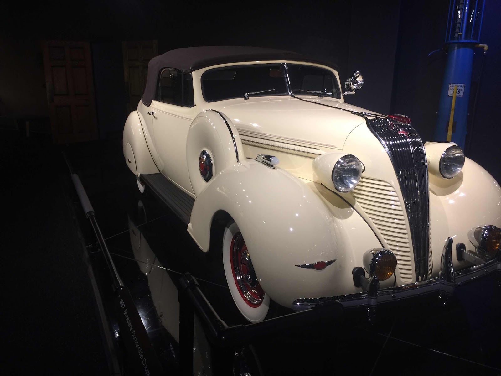
Above are a Deusenberg, and a Terraplane. Note the sliding door and landau top on the Kaiser Darin below.

(Thursday, August 1, 2019) First day on the road without my travel companion - Nikki flies back to SF from Denver this evening. This morning was a late departure (about 9:45) to avoid the traffic going into Denver, which I mostly did. South on CO 93 then wiggle around on I-70 and CO 470 to US 285 south, which climbs into the mountains. It is a busy road with a fair amount of truck traffic, but on a Thursday morning the traffic moved along at the limit, and there were plenty of places to pass. It follows the Turtle Creek canyon over the Kenosha Pass (10,000) feet and into the town of Fairplay, where I had lunch at the Java Moose coffee house and deli.
As you can see it had just rained. I started the day wearing my rain gear even though it was a pleasant 75 and mostly sunny in Boulder. I hit rain over Kenosha Pass (where it was 45 degrees) and there were off and on rain showers for the rest of the day. South of Kenosha Pass a few Harley bros went by going north with nothing on their heads but do-rags and wearing T-shirts and leather vests - I hope that they had something warmer and waterproof in their saddlebags. Just south of Fairplay there was a detour to the southeast on CO 9 to bypass construction on 285, but after about 20 miles I was back on 285 south into Poncha Springs where I got gas and went west on US 50. Again there were plenty of places to pass and the road was in good condition, and the 11,300 foot Monarch was easy, as was the 9500 foot Black Sage pass. Looking at the map I could have continued on 285 to Saguach and taken CO 114 to Gunnison, which would have only added 50 miles and 114 is a road I’ve never been on. There’s also another road, CO 149, to the southwest of Gunnison that looks interesting - next trip.
Since it was only about 3 PM I wandered around Gunnison after checking into the Western Motel, which is a well kept place and not part of a chain. I stopped in at the Turquoise Junction and Gun Room, which has jewelry in the front and a gun shop in the back - something for everyone. The shop dog is Kit, who was voted Top Dog in an annual charity election. Gunnison is home to Western Colorado University, and it has a lively downtown with several bars, tourist shops, gallery’s, restaurants, and even a large guitar shop.
While I was just finishing dinner at the Gunnisack in town, a guy called me from the motel to say that someone had knocked down my bike, so I hurried back to see what had happened. The bike was on its side stand and appeared to be fine, and soon Steve, the guy who had knocked it over, came by to apologize. He had attempted to ride his bike (a Suzuki Wee-Strom like I have at home) through my parking space just to the left of a small building, and his left pannier clipped my right pannier that was still on the bike. My bike rolled forward off the center stand and fell into Steve, whose leg was pinned between my bike on the left and his bike, which was now leaning against the building. His friends soon righted my bike, got Steve off his bike, and assessed the damage, which was mostly to Steve’s left hamstring, which was cramping and painful. Someone actually called an ambulance, and the EMT responder suggested X-Rays, but Steve would have none of it and insisted that he would be fine, and when I saw him he was better, but had already taken three Advil. He was with a two other people, and they had pulled in looking for a room but everything in town was booked. They finally found rooms in Salida, 60 miles east and over Monarch Pass, and set off, Steve still in pain and limping - I imagine that he’ll be very sore in the morning.
(220 miles)
(Friday, August 2, 2019) After a quick motel breakfast I left a little after 9 under overcast skies and 55 degrees. I didn’t wear rain gear, but did have on my warm jacket under the Aerostich and my warm gloves. I rode west on US 50 past Blue Mesa reservoir where John C. and John P. and I camped several years ago. After about 30 miles I turned north on Colorado 92 that goes through the Black Canyon of the Gunnison. This road is an absolute delight with sweeping turns, tight turns, and very tight turns and little traffic in the morning. The road is far above the river and there are a few ranches at the beginning and end, but mostly just a very exciting ride and beautiful scenery with elevations up to 9500 feet. The road surface is mostly good with good sight lines in the curves and places to pass (although no one passed me and I didn’t pass anyone), although there was one 7 mile section that had recently been chip sealed and there was a lot of gravel on the road - not unlike riding on marbles. I stopped twice to take pictures - once at the beginning and once near the end at Hermit’s Rest.
After about 40 miles I came into Crawford, where Andrew and I had breakfast at the Mad Dog Cafe about 20 years ago.
Joe Cocker, whose best known album is titled “Mad Dogs and Englishmen”, established the Mad Dog Ranch, which had summer programs for underprivileged kids, and I remember the Mad Dog cafe as being very reasonable and very good. There was an open sign but I didn’t see anyone, and of course Joe died a few years ago and I don’t think that the ranch is still operational. The Crawford ranch supply building is also interesting.
The weather had warmed somewhat and I continued north on 92 through Hotchkiss until it ended at Delta, where I picked up US 50 west to Orchard Mesa where I got gas, shed my warm gear, opened the vents on my jacket (it was 85 degrees by now) and made a reservation in Minden, NV for Sunday night. Back east on US 50 for a couple of miles and then I turned southwest on CO 141, a scenic road through a red rock canyon with a few ranches along the way. The road is in excellent condition, so I couldn’t complain too much about a 20 minute wait for road construction. I stopped at Gateway, a resort with a small but very interesting car museum. The Gateway complex was created by John Hendricks, who founded the Discovery channel, and the whole place, museum included, is for sale if you are interested. First I had lunch (excellent if a little pricey) at the Paradox Grille, and then I went into the car museum. I’d been there several years before with the Johns, so this time I just spent a brief 45 minutes wandering around admiring the cars.
Above are a Deusenberg, and a Terraplane. Note the sliding door and landau top on the Kaiser Darin below.
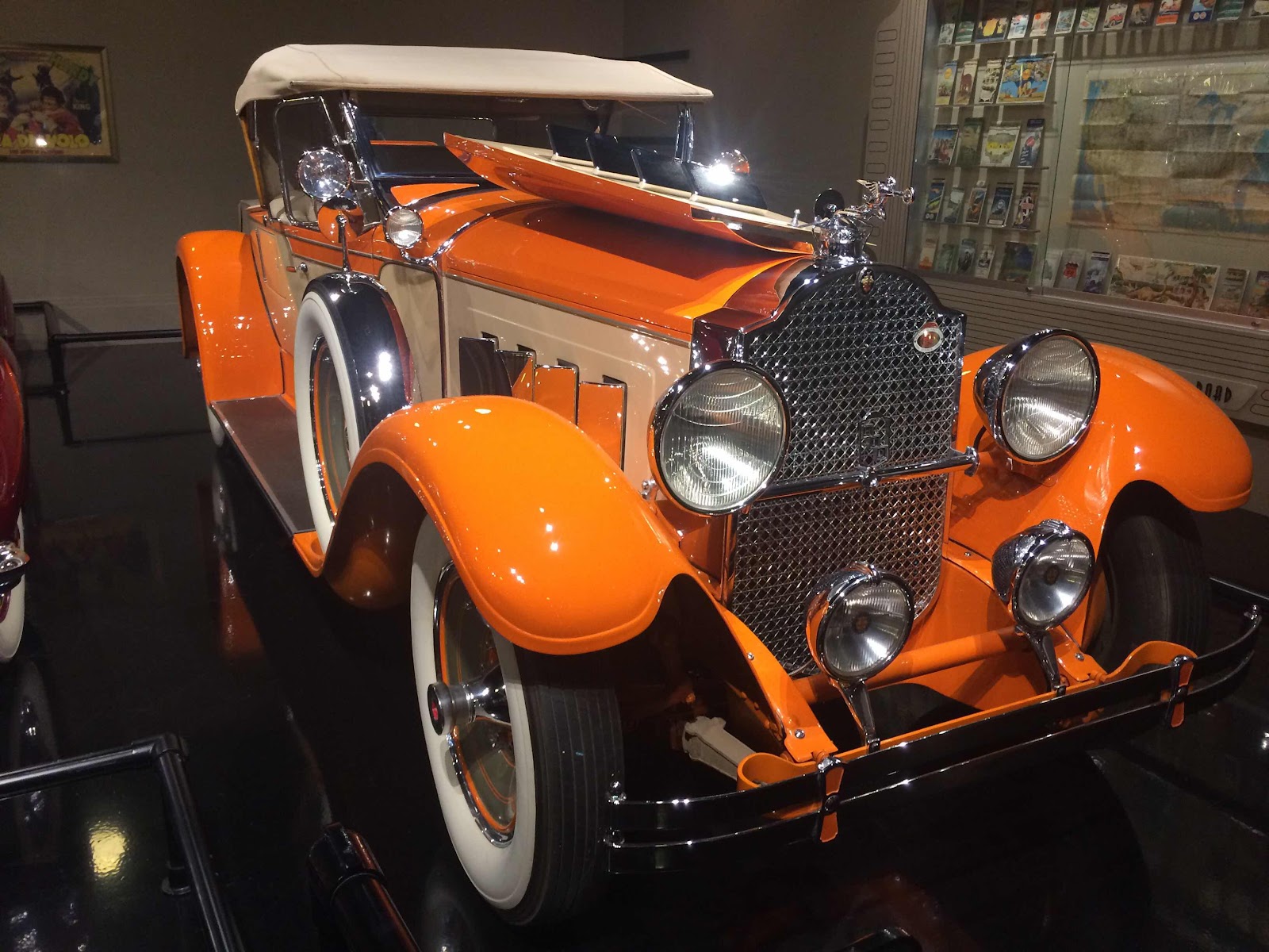
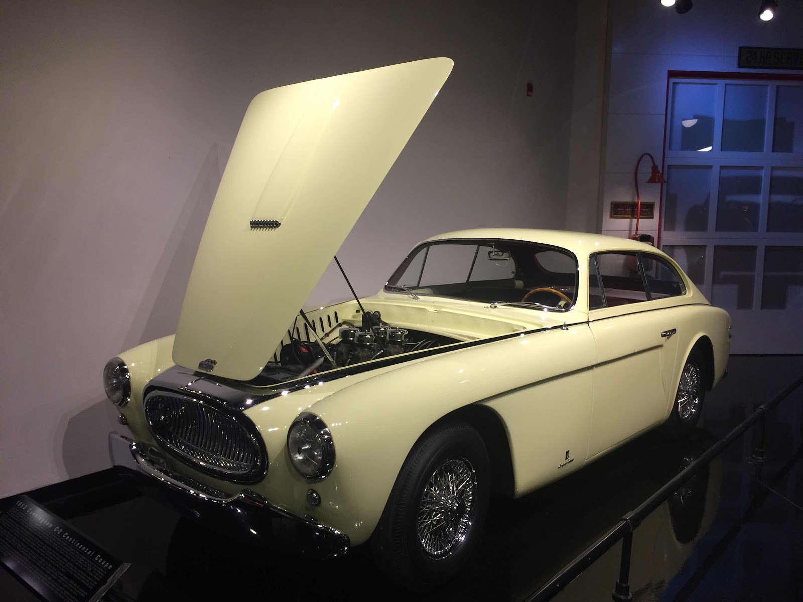
The orange Packard is striking, and I also like the rare C-3 Cunningham.
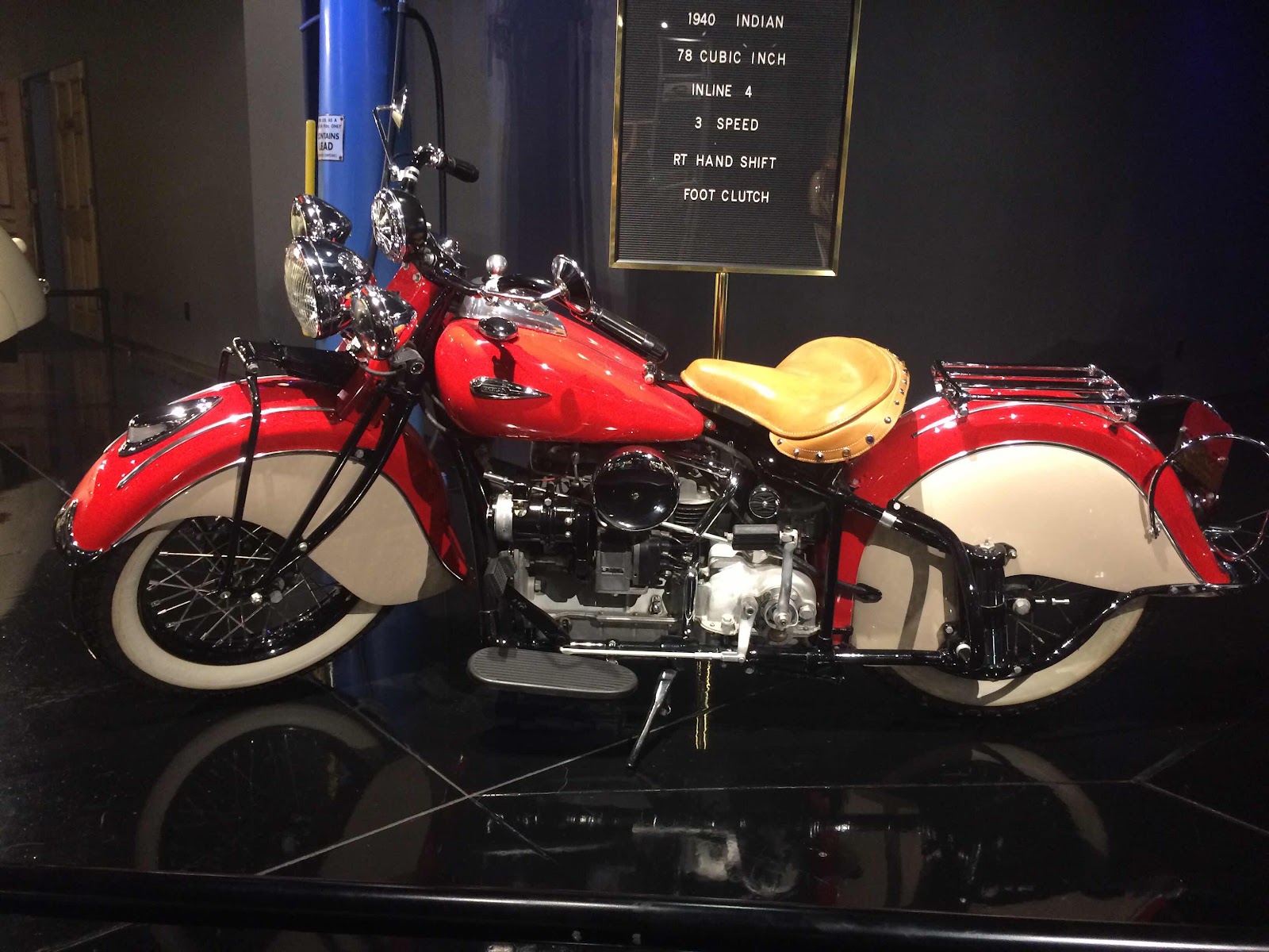
There are also a few motorcycles in the museum, including this 1940 Indian 4 and an old Indian board track racer.

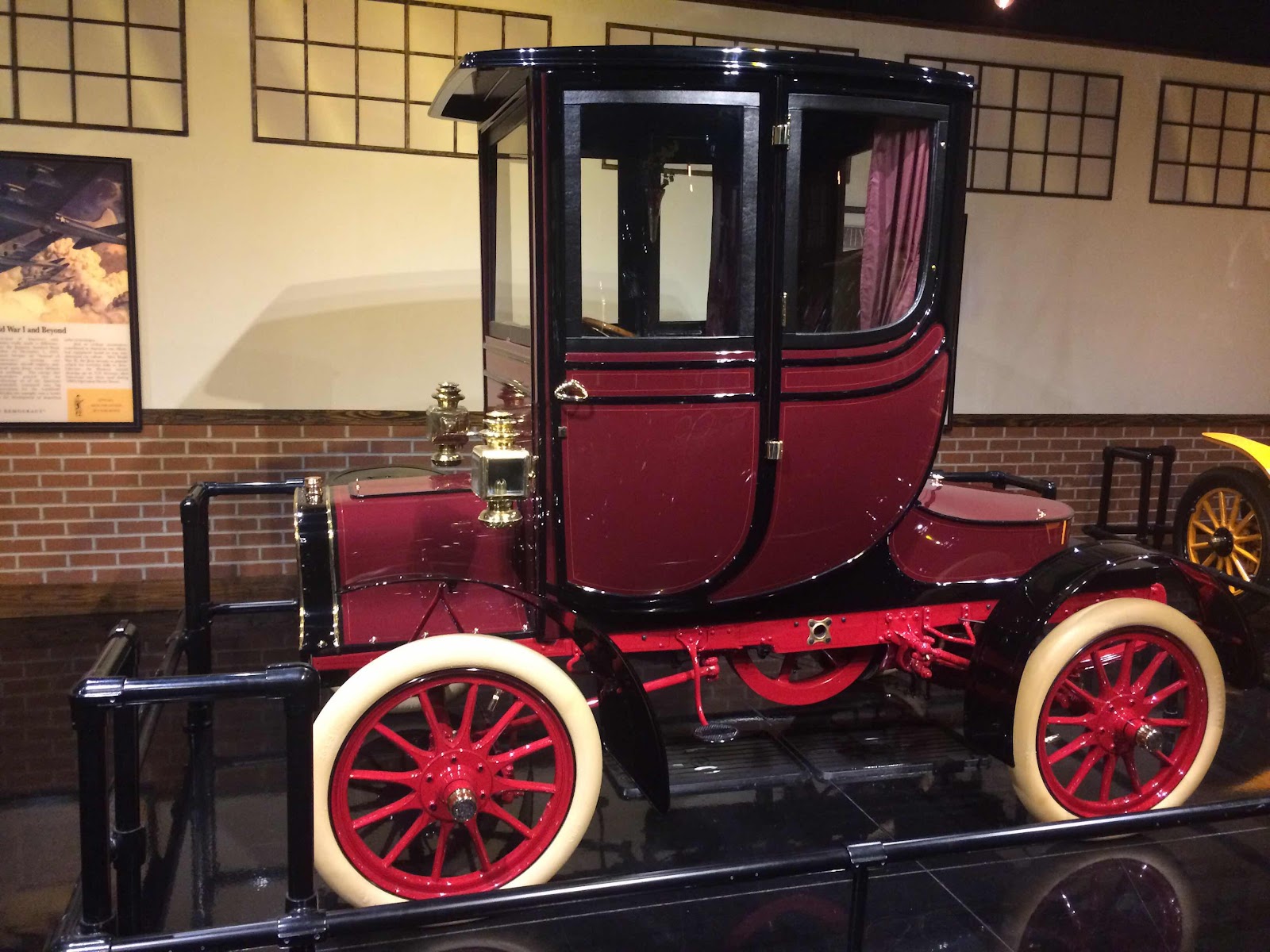
The 1903 (or 1906) 4 cylinder Cadillac is a beautiful restoration, as is the Auburn boat tail speedster.

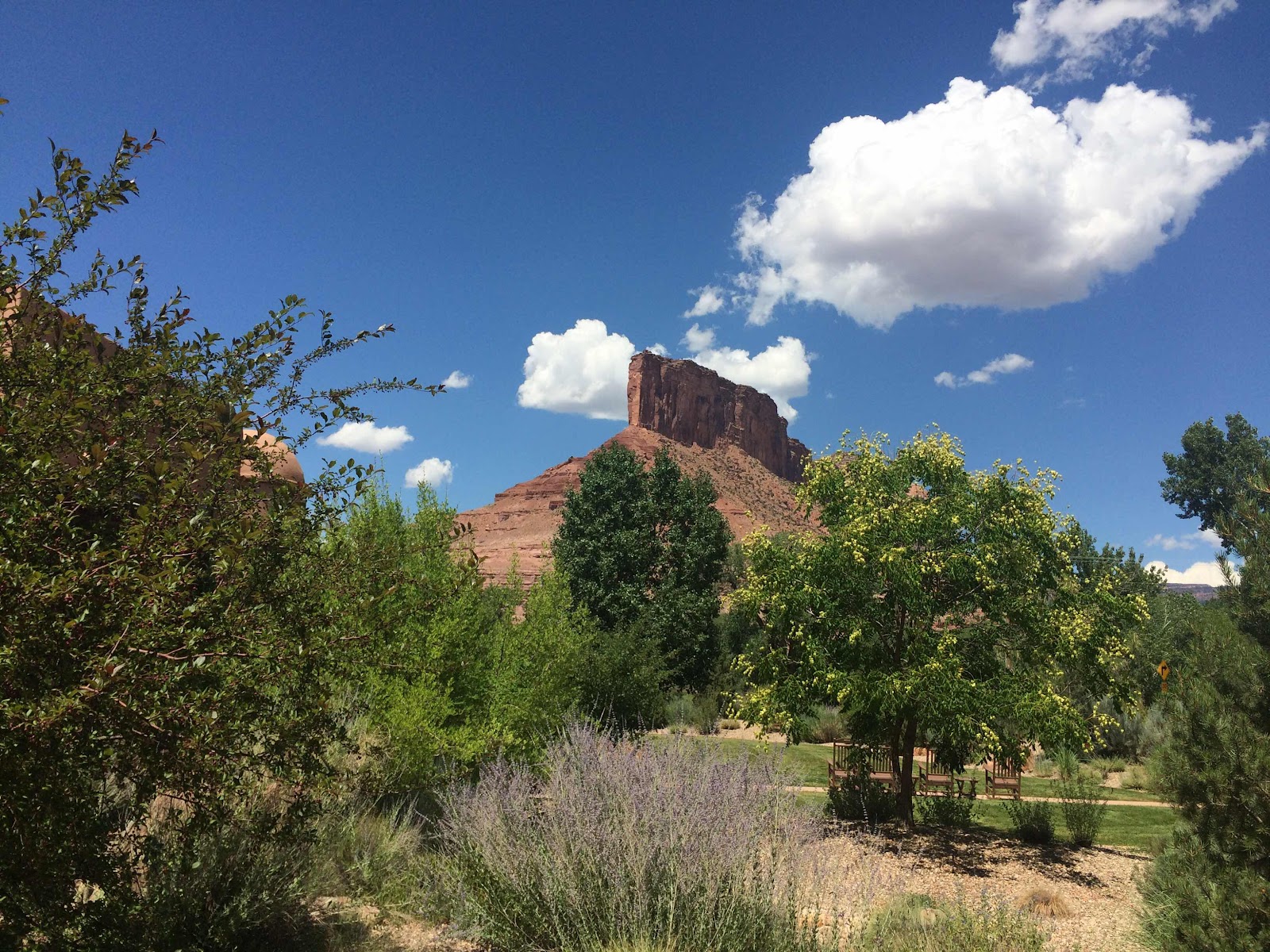
The Gateway complex is surrounded by striking red rock formations.
Leaving Gateway I went south on 141 through a red rock Canyon.
It had warmed up to about 95 degrees, but it was dry and as long as I was moving I was comfortable. Again there was little traffic on the road, which crossed the Dolores River a couple of times. Before Naturita I turned west on CO 90 and after about 20 miles took the one mile cutoff to the town of Paradox.

I’ve taken this same picture with other bikes about four times over the years and I don’t recall ever seeing anyone around. I did see a sign for the Paradox Valley Inn a couple of miles east of town, so perhaps there is life there.
West of Paradox it is only a few miles to the Utah border. and the road winds and twists over hills through another canyon until it flattens out and ends at US 191 which I followed south, past more red rock formations. In Monticello, where I got gas, I saw an old timber building that might have been a general store in the 1890s but was now a Thai and sushi restaurant. I soon came to Blanding, where I’m spending the night at the Cliff Palace motel, which was empty when I got here but at 9 PM I finally see another vehicle in the parking lot.

The place is OK, but hardly luxurious - no Kleenex or hair dryer - and Carol wouldn’t approve. I walked around town to pick up some fruit at the grocery store and saw two large motels (a Super 8 and Rodeway Inn) that were also very sparsely patronized. The town of Blanding seems to be dying. Andrew and I camped at the Blanding RV park almost 20 years ago, and it was livelier then. (344 miles)
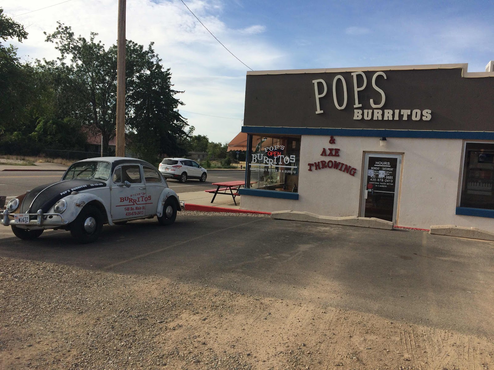
(Saturday, August 3, 2019) Last night I had dinner at Pop’s Burritos, which was just across the parking lot from the motel. I also had breakfast there since it was close and I didn’t want to wander around town looking for a restaurant. No, I did not see the axe throwing demonstration.
When I left Blanding at 8:30 and headed south on US 191 it was 75 degrees and partly cloudy. After four miles I turned north and east on Utah 95, which is 100 miles of good road through the Fry and Glen canyons with some good twisties at the beginning and the middle. It is very scenic with red rock canyons and rock formations and at that time of morning there was almost no traffic. As I neared Hanksville after about 100 miles I saw quite a few trucks towing boats going in the opposite direction and headed for Lake Powell to which there is access from UT 95. Hanksville hasn’t changed much over the years - the store in the rock at the Sinclair station seems to be doing good business, and there’s an “art” installation that has grown since I was last there.


I was happy to see that the rock shop, abandoned for many years, has a new owner and is open again under a new name - the Rockin Riddle Rock Shop.

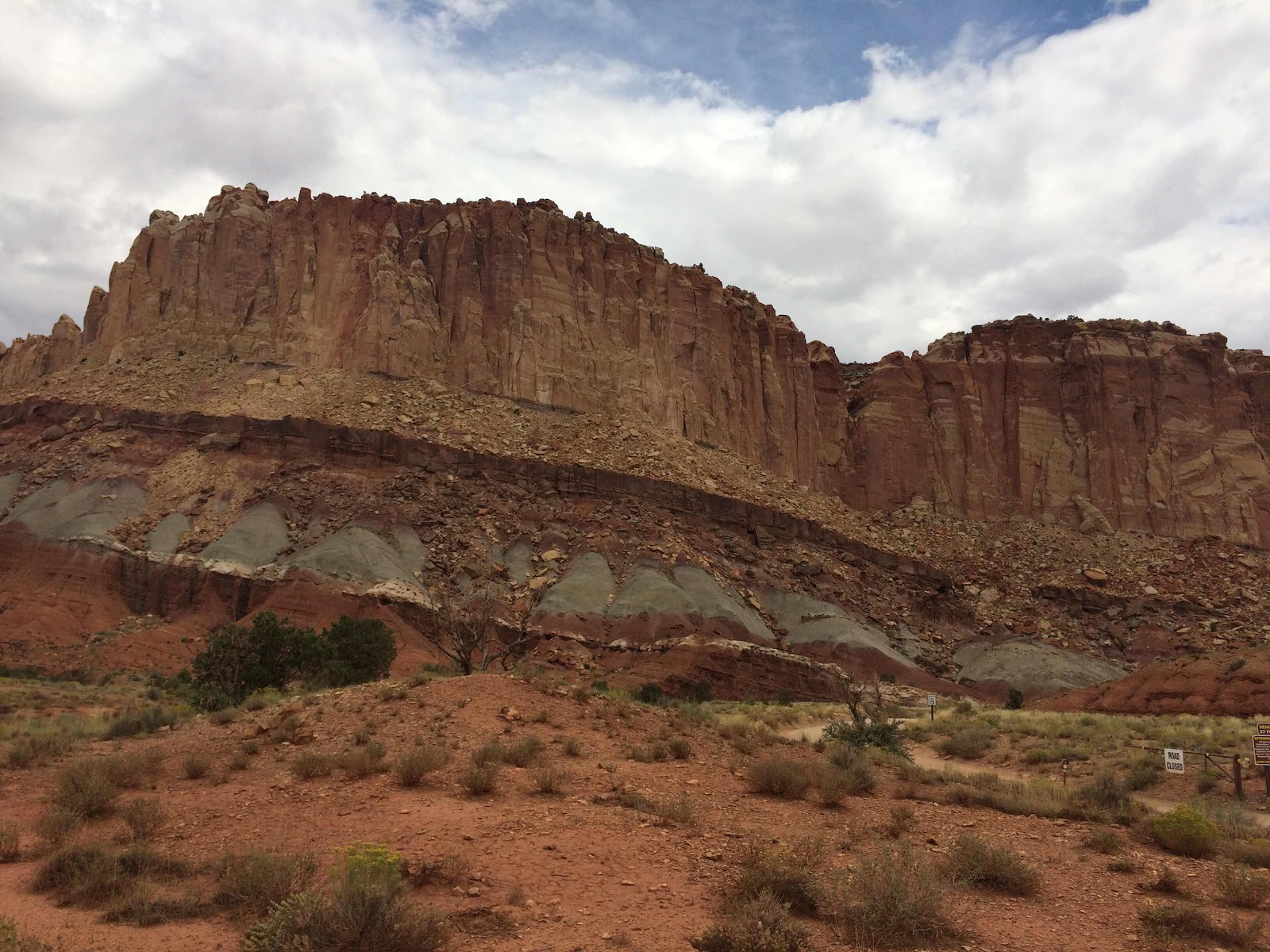
I rode west on UT 24 out of Hanksville and enjoyed the scenery, lack of traffic, and the curvy road until I pulled in at Capitol Reef National Monument. I’d never stopped there on my previous trips because I was always having too much fun on Highway 24, but today I decided to finally check it out. I stopped briefly at the visitors’ center and found that there was a scenic road that was 10 miles long, so I followed that for four miles and turned around and went back. The scenery was striking, the red rock formations were interesting, but really there wasn’t much that I hadn’t already seen on UT 95 earlier in the morning. Also, the speed limit was a frustrating 25 mph and there were quite a few sightseers.
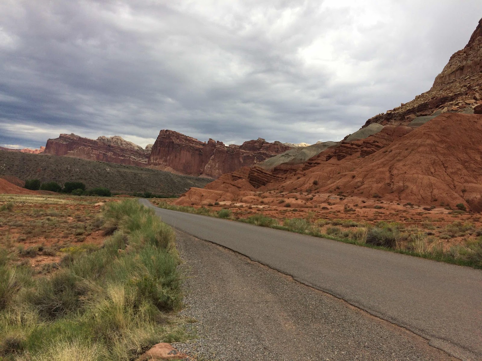


As you can see from the pictures the sky was overcast and it became darker after I left the park and continued west on 24 to Torrey, where I stopped for gas (topped up the tank because I didn’t know if there were any stations on my backroads route) and lunch at the Castle Rock Coffee shop, which has very good coffee and sandwiches.

The couple on the blue Goldwing in the background had just come in from the west and they said they were hit with rain and hail, so I put on my rain pants and gloves, closed the vents in my jacket, and went on my way. Over the next two hours I did hit a few showers, but nothing heavy and it was a pleasant ride through a valley bounded by the Fremont River and Otter Creek. In Koosharem I went south on UT 62 and followed that to US 89 where I went south to Panguitch. The GPS had wanted me to go west on UT 20 about 10 miles north of Panguitch, which would have taken me to I-15, but the weather seemed to be clearing and I thought I could ride a more interesting route. From Panguitch I went west on UT 143, which climbs up to Panguitch Lake past ranches and recreation areas. This is high country and seeing 8500 feet on my Garmin was not unusual, and there were several places over 9000 feet. I went south on UT 148 to Cedar Breaks National Monument, which has a visitor’s center, hiking trails, and a campground. Quite a few people were about, enjoying the 10,500 foot elevation, I guess. I’d been through there once before and had decided that it was a slow road and the scenery wasn’t anything I hadn’t already seen, but I thought that since today was a short one I might as well check it out again. I think that I’m done with it now. UT 148 ends at UT 14, also known as Cedar Canyon road, which leads to Cedar City. I usually enjoy this road, but this afternoon there was a lot of traffic, and several areas of road construction, two of which had one-way lane control signals. I had to wait at one for about 10 minutes, but got through the second without stopping. There was a half mile line of cars waiting to go east when I rode through the first signal.
In Cedar City I found the Super 8 by the Interstate and checked in. This is the worst motel of the trip so far, but it is also the cheapest, so I guess that makes sense. The bath mat was soggy, the tub drain is slow, and there was no shampoo. Without going a mile back into town my dining options were a Subway and a Mexican restaurant in the Ramada Inn across the street - I chose the Mexican place and it was OK. (343 miles)
(Sunday, August 4, 2019) Last night I forgot to turn on the alarm and so woke up at 6:15 instead of 6 like I’d intended. After a quick breakfast at the motel (I may give up on motel waffles) I packed and chatted a bit with members of the Immortals motorcycle club from Thailand, who pulled in about an hour after I did last night. They were on 9 or 10 bikes and except for a couple of guys from LA, all were from Thailand. They were headed to Sturgis and said they were having a great time.
It was a pleasant 78 degrees under an overcast sky when I left the Super 8 at 8:45 and I headed east on UT 56, which is a relatively straight road that goes through a couple of small towns for 60 miles before it ends at the Nevada border and becomes NV 319. This road has a few curves and goes over a 6300 foot pass before ending in Panaca, where I turned south on US 93 through Caliente and over Oak Springs Summit (6300 feet) and then to Alamo Springs, where I got gas for the haul to Tonopah. I backtracked on 93 for four miles and turned north on UT 318 and then quickly onto UT 375, the Extraterrestrial Highway and after 40 miles stopped in Rachel, which makes the most of its proximity to Area 51.

The Little A’Le’Inn was doing a surprising amount of business on this Sunday morning - a few locals at the bar, and maybe half a dozen travelers like me having a snack and checking out the Area 51/alien paraphernalia that was for sale. I had Alien Berry pie (raisins with a coconut /vanilla crust) and coffee, and both were good. Back on the road it had warmed up to 90 and the skies had long since cleared. It was a beautiful day in the desert and I cruised along at the 70 mph limit and enjoyed the lack of people, cars, and any other indications of civilization except the road. There were a few 5-6000 foot passes n the next 60 miles to Warm Springs (nothing there anymore) where 375 ended and I went west on US 6 to Tonopah, a town that I keep trying to like but which always disappoints. I got gas and searched for the Stage Stop Cafe, which had showed up on my GPS, but the address was for a casino, so I went back into “downtown” and finally had lunch at the Mizpah Hotel. Back on the road I continued north on US 6/95 to Coaldale, where 6 went east and I went north on 95. The day was sunny and warm with temperatures mostly around 95 degrees, although it did get over 100 in a few places. This area is all part of the Great Basin and is mostly around 5-6000 feet. North of Hawthorn 95 went by Walker Lake, an unexpected sight in this desert landscape. In Yerington I got gas and went south on NV 208, which I followed to US 395 where I went north and joined quite a few other travelers who were probably heading home after a weekend in the Sierra further south. I arrived in Gardnerville and checked in at the Village Motel and then had dinner in the cafe at nearby Sharkey’s, a casino. Gardnerville has a pleasant downtown area along US 395, although I went by a Walmart on the south end of town. The small towns in Nevada are all large in area, so one spends a lot of time driving at the 25 mph town speed limit although there is very little around to run into. I saw as many cops today as I have in the previous two weeks of the trip.
Tomorrow I’ll sleep in and then have breakfast at the Carson Valley Inn with Dave, a friend I used to work with. We get together every couple of years and try to solve the problems of the world, and you can see how well that is going. (512 miles - longest day of the trip)
(Monday, August 5, 2019 - last day of the trip) This morning there was no rush because I was having a late breakfast at the Carson Valley Inn. I walked over to Nevada Coffee and had coffee and a scone and watched the traffic on US 395, Garnerville’s Main Street. Back at the motel I checked the tires, packed, and left a little after 9. After getting gas for the bike I rode around Gardnerville a bit, and discovered that there is a second business district - the old Gardnerville - a block to the west of 395. Breakfast at the CVI was good, as always, and I enjoyed talking with Dave about everything from communications technology to politics. We parted a little before noon, and I rode back to the motel to retrieve my reading glasses, which I’d left in the room (I discovered this when I reached for them to read the breakfast menu). Finally on my way at about 12:15, I turned onto CA 88 in Minden, NV (for some reason 88 is the same number in Nevada and California) and soon crossed into California, and after a few miles turned south on CA 89, which I followed through Markleeville (a picturesque little town that I’ll have to stop and visit sometime) and soon turned west on CA 4. By this time I was definitely in the mountains and the road gained elevation through a series of curves as it made its way to Ebbetts Pass. The surface was in good shape, and there was little traffic. A couple of cars pulled over or slowed and motioned me to pass - in fact on the whole mountainous stretch of CA 4 half a dozen drivers did me that courtesy. For the 10 miles before and the 10 miles after Ebbetts Pass (8700 feet) CA 4 doesn’t have a center line because the road is really too narrow for two lanes - when cars meet from opposite directions they have to move as close to the edge of the road and slow way down to pass by each other. Not a problem on a motorcycle. I passed a couple of hard working bicyclists going up and passed one going down, and after Alpine Lake (at 7500 feet) the road finally became two full lanes with a centerline and everything. I rode by Bear Valley (where Carol and I used to ski) and had a good ride as far as Big Trees State Park, where I finally caught up with cars and trucks and road construction. There was one way lane control in two places, and at Arnold I pulled into the Bistro Espresso for what I’d planned to be a snack, but which turned into lunch - good food and good coffee. By this time 4 had run out of fun with more traffic and fewer curves, so I took the Angels Camp bypass through Murphys, which has become quite a destination little town with galleries, wineries, shops, and events. After Murphys there’s a 6 mile section of nice curves on Murphys Grade Road until it ends at Highway 49. After a short stretch I turned west and picked up 4 again. There’s a nice section of curves for 10 miles before Copperopolis and I was able to enjoy about half of that distance before catching up with traffic, which to be fair was moving right along. By this time the terrain had become the rolling, grassy hills of the Sierra foothills and there’s a strange section of very pronounced rolls for several miles before the road flattens out near Farmington, where I turned south on county J6. The Garmin had me jogging around a bit on small farm roads before I went west on CA 120 near Manteca and soon headed south on I-5. After a few miles on I-5 I went west on I-205 to Tracy, where I stopped for gas and to text Carol with my estimated arrival time. I-205 was fine heading west, but all the lanes were choked going east out of the Bay Area. 205 runs into I-580 and I followed that to Hayward and CA 238 to I-880 south and then CA 92 across the San Mateo Bridge. The weather had started out at 77 degrees under clear skies in Gardnerville, gone up to 85 at noon, and then in the Sierra it dropped back to 75 under increasingly hazy becoming overcast skies. It was 95 in Angels Camp, and by San Mateo it was about 70. I took highway 92 to I-280 and then CA 1 to Skyline to Sunset to home, where it was 57 degrees with fog.
Carol came out as soon as the garage door opened, and after a little greeting we went inside where Walter was very anxious to see me. I took him outside for the traditional end-of-trip picture. As you can see in the second picture he appears to be trying to climb aboard for a ride.


The trip lasted two weeks and covered 3,860 miles. Almost everything was familiar territory, but that doesn’t mean that the scenery or the riding was boring - far from it. Good weather for almost the entire time, good roads, and I enjoyed riding with Nikki, who proved to be an excellent passenger, and she didn’t even give me too hard a time when I dumped her on the side of the road. My new hip held up well, and I’m ready for another ride, but first I have to do a laundry and take care of a few maintenance items around the house. (265 miles on this last day)
No comments:
Post a Comment